- File size:
- N/A
- Date added:
- Jan 30, 2025 | Last update check: 1 minute ago
- Licence:
- Freemium
- Runs on:
- Web browser on your preferred device: mobile, tablet, laptop, or PC.
Hektar is a web-based AI-powered tool designed to assist urban planners, architects, property developers, and municipalities in early-stage massing generation. Leveraging generative design, it enables users to create and evaluate multiple design proposals while integrating zoning regulations, typologies, site constraints, environmental factors, and economic feasibility into the planning process.
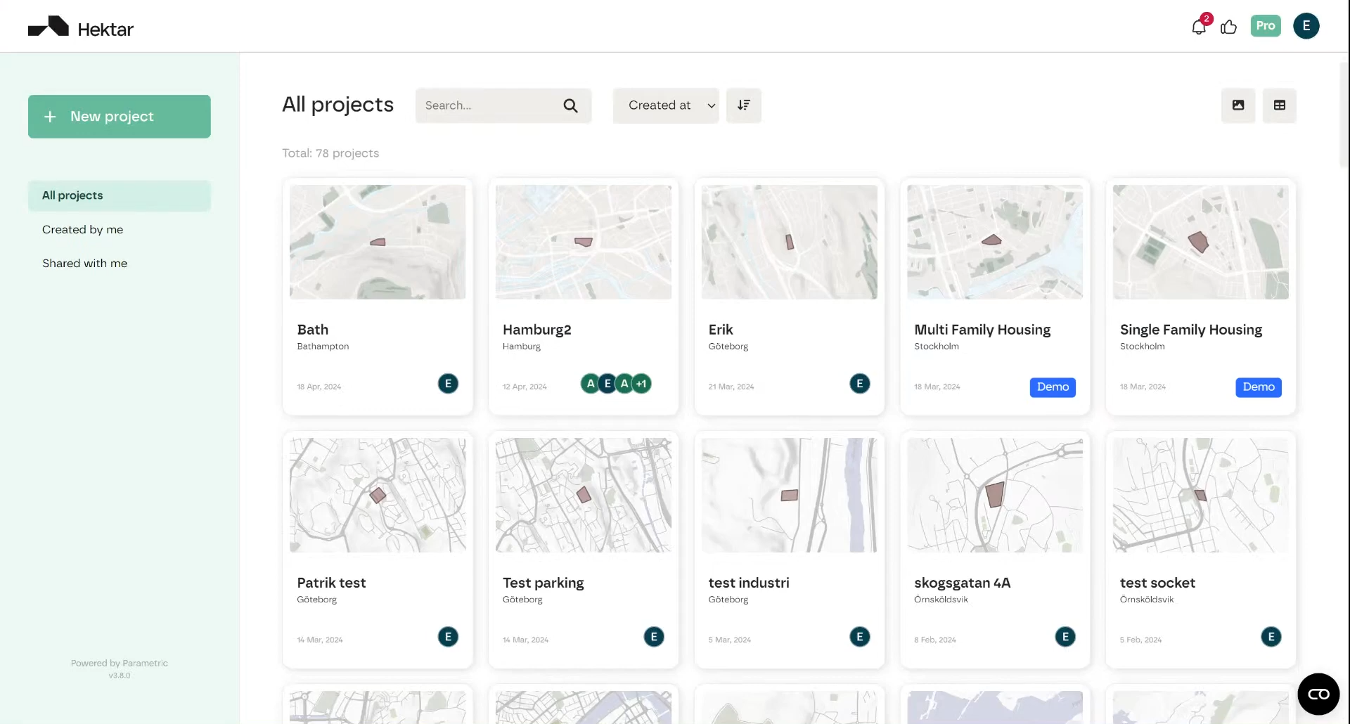
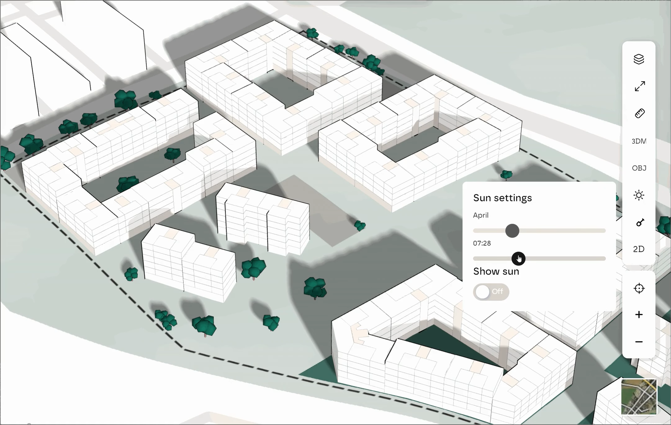
Generate massing studies. Hektar’s primary feature is its ability to generate massing solutions based on inputs and constraints primarily related to zoning regulations and urban planning metrics, including site boundaries, access points, street setbacks, non-buildable zones, greenery, parking requirements, typology, building depth, building height, density limits, Floor Area Ratio (FAR), Open Space Ratio (OSR), and Gross-to-Net Ratio. Its generative algorithms use evolutionary computation to refine massing scenarios, optimizing design feasibility while maintaining quality of architectural design. The tool provides real-time feedback on key planning metrics, allowing users to iteratively refine their proposals. Hektar also offers scenario comparison, a 3D viewer for visualizing massing proposals, as well as sharing and collaboration through direct invitations with role-based permissions or public links.
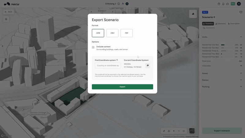
Hektar integration. Users can upload DWG, DXF, SHP (Shape), or image files (JPEG, PNG) as a reference overlay on the map when setting up a project in Hektar. The platform supports exporting generated models in OBJ, 3DM, and CSV formats, enabling integration with Rhino and other 3D modeling software for a smooth transition from conceptual design to detailed modeling. Hektar utilizes Mapbox and OpenStreetMap for global site accessibility, allowing users to conduct feasibility studies anywhere in the world with real-world geographic and zoning data. Its ability to aggregate open-data sources enhances geospatial awareness, making it a useful tool for municipalities and developers.
Licensing & pricing plans. Hektar offers three pricing plans. Hektar Free is a basic version that allows users to explore generative design features with some limitations, providing access to Hektar’s core functionalities. When you sign up for a Hektar Free account, you get unlimited access with no trial period or credit card required. Hektar Pro includes export features and access to key statistical data for enhanced decision-making. Hektar Enterprise is designed for large teams and companies, offering customization options such as specific apartment module configurations.
Summary. Hektar is an AI-driven urban planning platform focused on early-stage massing generation, feasibility studies, and zoning compliance. It supports architectural conceptual design by enabling users to explore building typologies, density, and spatial configurations on a broad scale, as well as test development feasibility before transitioning to detailed architectural design. Hektar enhances efficiency across key user groups: architects gain more time for creativity with automated site and feasibility analysis workflows; property developers benefit from instant economic feasibility assessments, optimized site evaluations, and shareable 3D models that accelerate project approvals; municipalities gain a comprehensive urban planning solution that integrates geospatial data, simplifies volume studies, and ensures seamless collaboration between stakeholders.
Typical workflow
This is a typical workflow for choosing the most feasible design option:
- Set up a new project. Select a site from OpenStreetMaps and define the site boundary. Input critical project details such as plot size, typology (lamellas, point houses, or quarters), building heights, and parking solutions. Customization options include adjusting boundary offsets for sidewalks, choosing parking norms, and specifying non-buildable areas and access points.
- Explore design scenarios. Once the constraints are set, Hektar’s AI-powered algorithm generates multiple design proposals, each visualized as thumbnail previews.
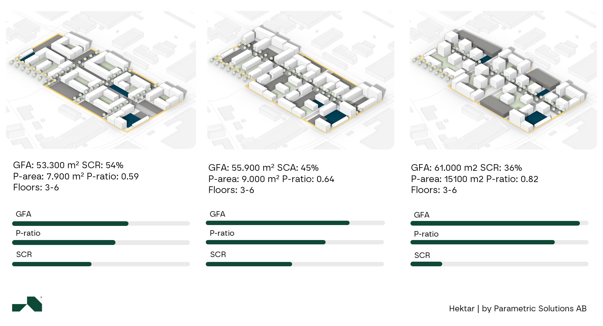
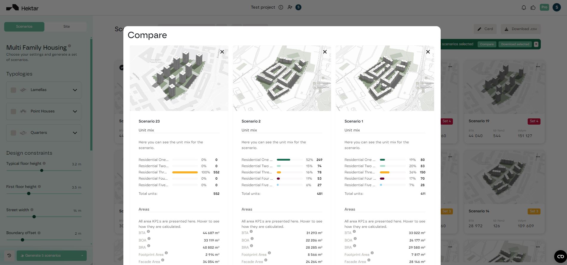
- Compare design options. Users can select and analyze different layouts, comparing them based on unit distribution, total floor area, parking ratios, and open space allocation. If the generated options do not align with the project requirements, users can easily modify parameters and regenerate new designs. Switching between typologies (e.g., from quarters to lamellas) provides alternative perspectives on the best urban massing approach for a given site.
- Refine design options. To align proposals with project goals, Hektar includes a filtering system that allows users to fine-tune their selections based on target demographics, apartment sizes, and overall unit composition. For example, if a client prefers a family-oriented neighborhood, users can prioritize designs with a higher proportion of larger apartments while maintaining a mix of smaller units for balance. This feature ensures that massing proposals meet both market and functional demands.
- Finalize and iterate on designs. Once a suitable design is selected, users can further analyze key metrics such as floor area ratios, open space ratios, and parking efficiency before deciding on the most feasible option.
Gallery