- File size:
- 65 MB
- Date added:
- Feb 08, 2024 | Last update check: 1 minute ago
- Licence:
- Freeware
- Runs on:
- Web browser on your preferred gadget, tablet, laptop or PC
Cesium is an open-source platform for creating powerful 3D geospatial applications, combining global content with user data. It was created by Analytical Graphics Inc. (AGI) and released in 2011. Cesium allows users to create virtual globes, maps, and other 3D applications that can be accessed from a web browser. The platform uses WebGL, a JavaScript API for rendering interactive 3D graphics within any compatible web browser without the use of plugins. It has been used in a wide range of applications, including defence and intelligence, architecture and construction, urban planning, and gaming.
CesiumJS and Cesium ion. CesiumJS and Cesium ion are related components in the Cesium ecosystem. CesiumJS is an open-source JavaScript library for creating 3D maps and geospatial applications in a web browser, while Cesium ion is a cloud-based platform that provides services to optimize, host, and manage geospatial content for use in CesiumJS applications. Cesium ion complements CesiumJS, and together they offer a comprehensive solution for building 3D geospatial web applications.
Features
- High-quality visualization: Cesium provides a rendering engine for realistic 3D representation of terrain, buildings, and objects. This allows users to create immersive applications that simulate real-world environments.
- Geospatial data integration: Cesium integrates various geospatial data types, including satellite imagery, terrain data, and 3D models. This allows users to create accurate and detailed representations of the Earth and other planets.
- 3D tiling: Cesium enables rendering large 3D geospatial datasets by breaking them into point clouds, buildings, photogrammetry, and vector data.
- Interactivity: Cesium allows the addition of interactive elements like mouse/touch controls, animations, and visual effects to create dynamic applications.
- Open-source: Cesium is an open-source platform built on a modern web stack that includes HTML5, CSS, and JavaScript. This enables developers to customize the platform, add new features, and create custom applications by accessing and modifying the source code.
- Software compatibility: Cesium has the ability to integrate layer imageries from various sources including OpenStreetMap, Bing Maps, ArcGIS MapServer, and standard image files. It can also integrate external WMS and TMS.
- International libraries: Cesium includes math libraries supporting major reference frames like WGS84 and ICRF.
Typical workflow
- Data preparation: Import and convert geospatial data from various sources like KML, ESRI Shapefiles, and JSON, into a format that can be utilized within the platform.
- Application development: Customize the appearance and behavior of the applications by using Cesium’s APIs and tools, which offer dynamic visualization, geospatial data integration, and interactivity features.
- Testing: Once the application is developed, it needs to be tested to ensure that it functions properly and meets the desired requirements.
- Deployment: Once the application has been tested and approved, it can be deployed to the desired platform or server.
- Maintenance and updates: After deployment, maintain and update the application as needed.
Gallery
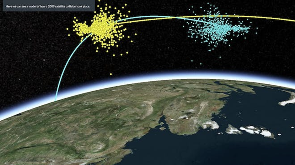
Create 3D geospatial presentations ©Cesium
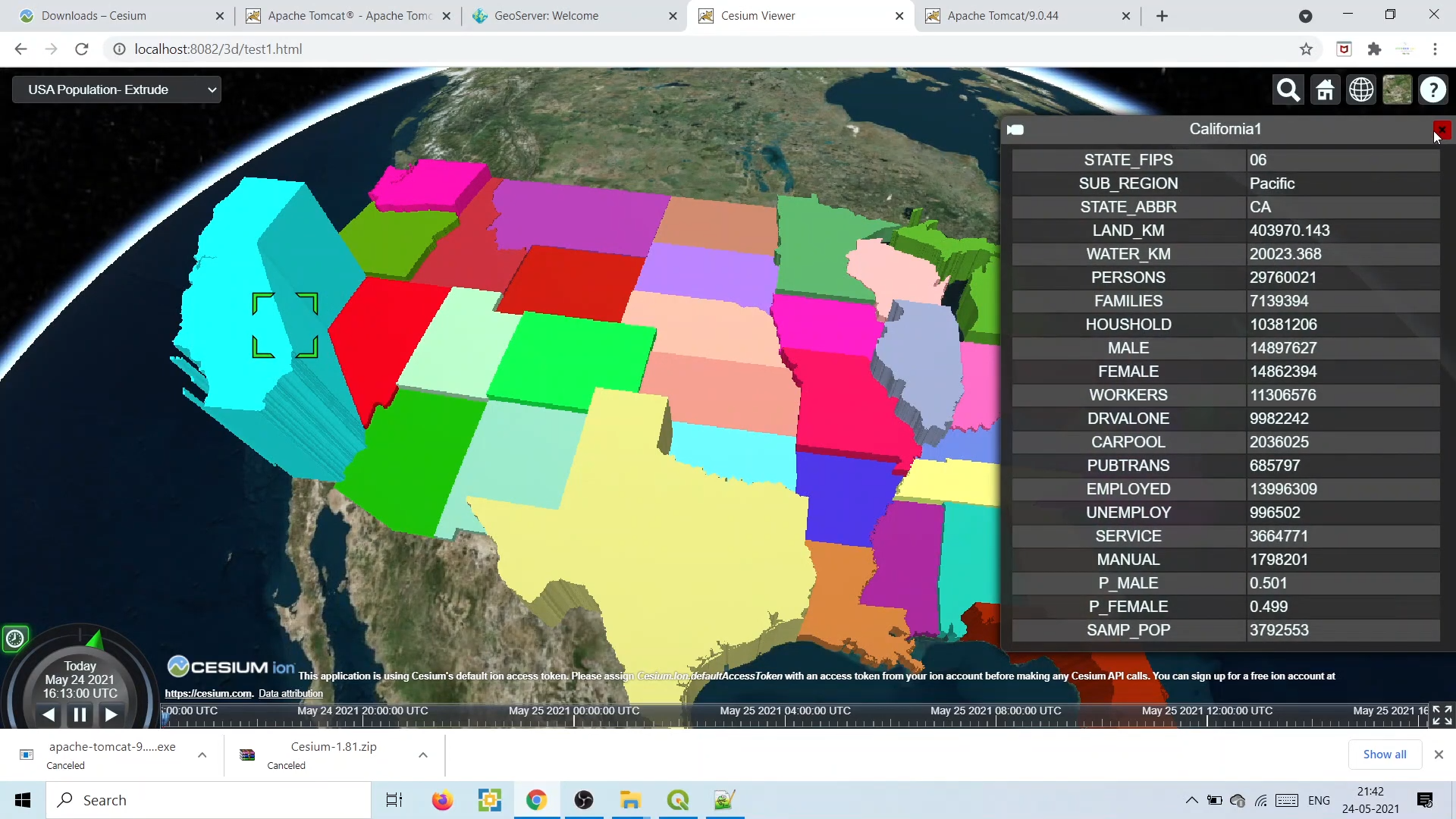
Extrude data rich 3D buildings ©OpenGeo Lab
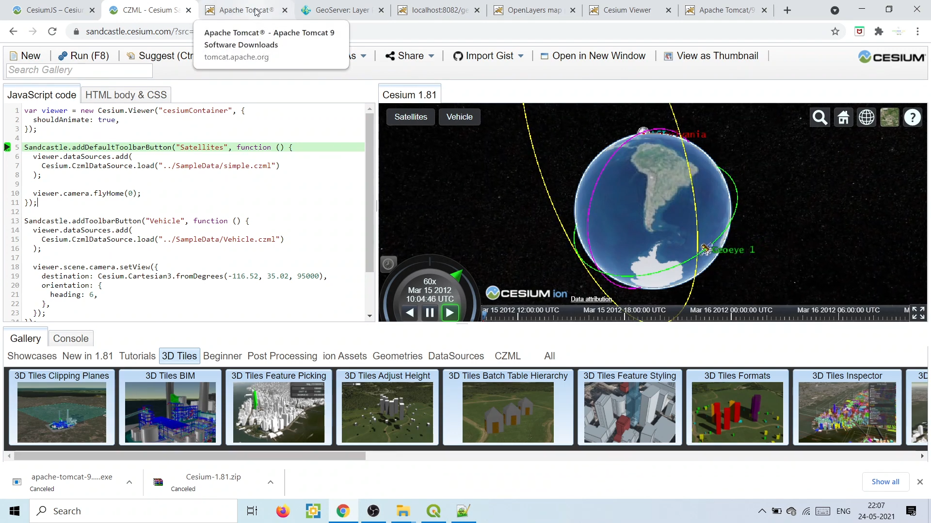
Modify the source code to create custom applications ©OpenGeo Lab

3D tiles of 3D buildings ©Nearmap