- Date added:
- Jan 11, 2025 | Last update check: 1 minute ago
- Integrations:
- —
- Licence:
- Trial | Buy Now
- Runs on:
- Windows 10 64-bit / 11 See Autodesk's Product Support Lifecycle for support information
Civil 3D is a civil engineering software for detailed design that supports BIM workflows with integrated design, analysis, and documentation tools. It is used in civil engineering, surveying and land planning. You have the ability to import a variety of survey data from Field Book files to ASCII files of a variety of formats.
You can use Civil 3D in conjuction with InfraWorks and Revit. A workflow that uses Civil 3D and Revit together allows a new level of collaboration which improves coordination and helps minimize miscommunication. Once the preliminary work has been completed in InfraWorks, you can bring your work into Civil 3D to complete the detailed design work required.
The InfraWorks model can be opened from within the Civil 3D interface. The point cloud data can also be viewed and analyzed within the Civil 3D environment. You can take accurate surface generated in InfraWorks and use it for detailed design in Civil 3D. The accurate point cloud surface becomes an integral part of the Civil 3D model. When accurate existing conditions data is available in Civil 3D, detailed design can begin within the context of the actual project location. Now it’s easy for designers, builders and users to see how a civil project will look and function within its real-world location before construction starts.
Autodesk’s infrastructure products family include Civil 3D, InfraWorks, and Recap Pro.
What’s new
Version 2025
- Surfaces: Improved performance with large surfaces, MMS files are now only saved when surface modifications occur, and enhanced multithreaded contour regeneration.
- Corridors: Streamlined process for setting up corridor models with multiple baselines, allowing designers to set up these elements in one click and featuring significant UI updates.
- Dynamo for Civil 3D: Upgraded from 2.0 to 3.0. Introduced new Package Manager, improved Search functionality, and updated Object Binding.
- Coordinate systems and Esri basemaps: Improved coordinate system setup with enhanced UI, support for NAVD 88 vertical datum, and expanded coordinate systems database, alongside integration of five Esri basemaps for enhanced visualization of terrain and structures.
- Autodesk Assistant integration: AI-driven chat support, allowing users to access tailored assistance, chat with product support agents, and create support cases directly from within the software.
Gallery
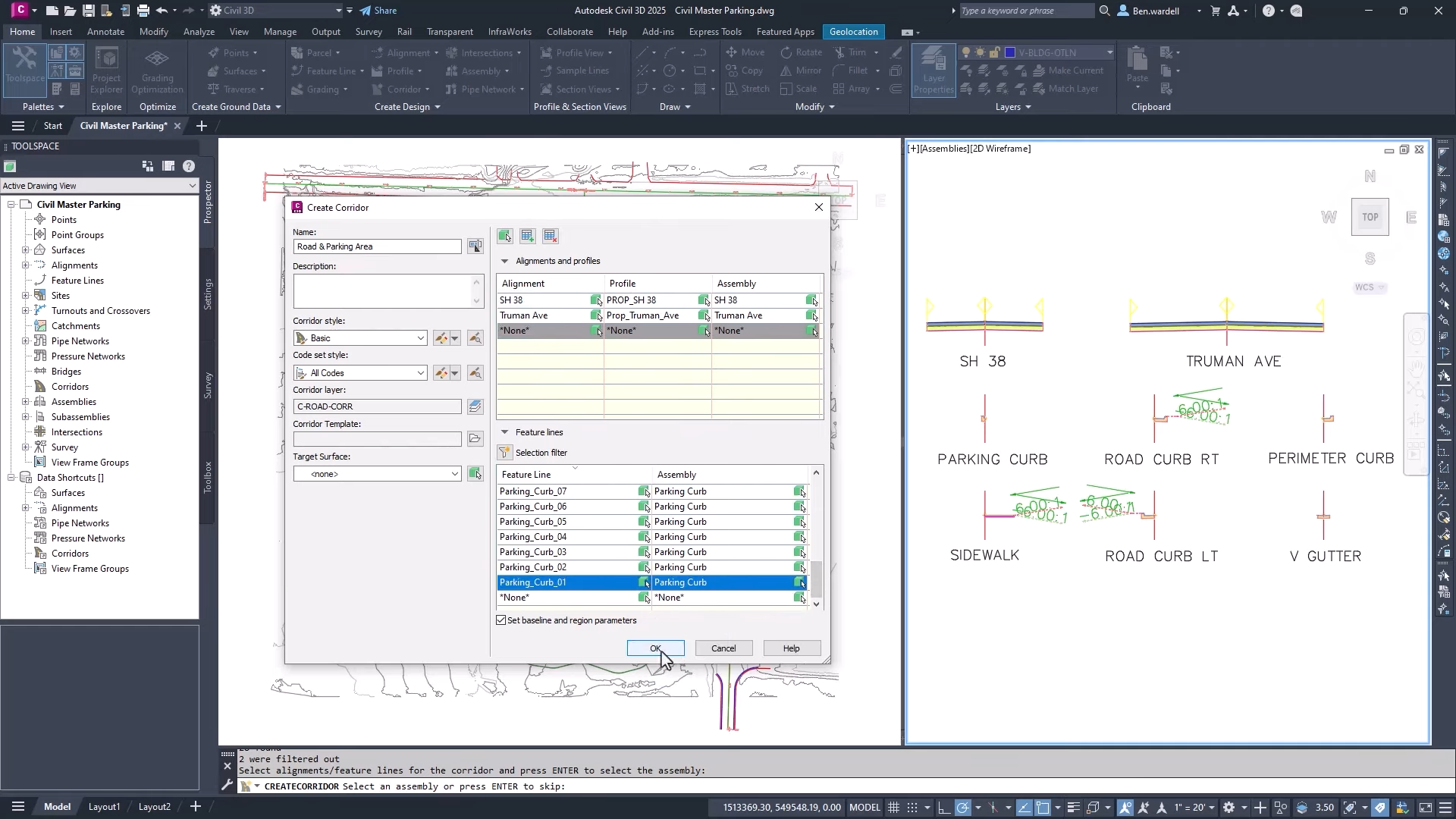
Civil 3D 2025: Create multi-baseline corridors faster. ©Autodesk
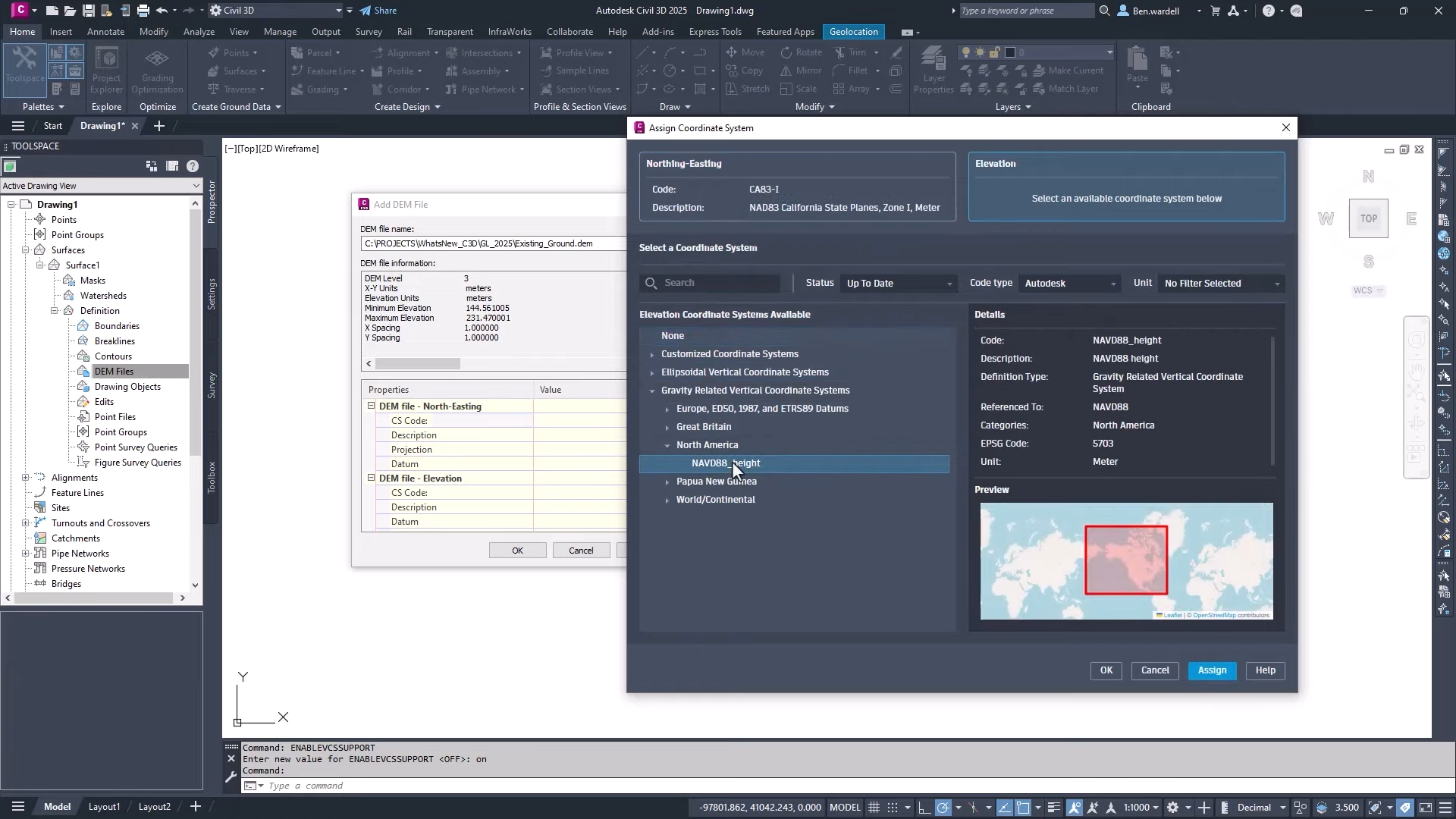
Civil 3D 2025: More intuitive setup and creation of coordinate systems. ©Autodesk
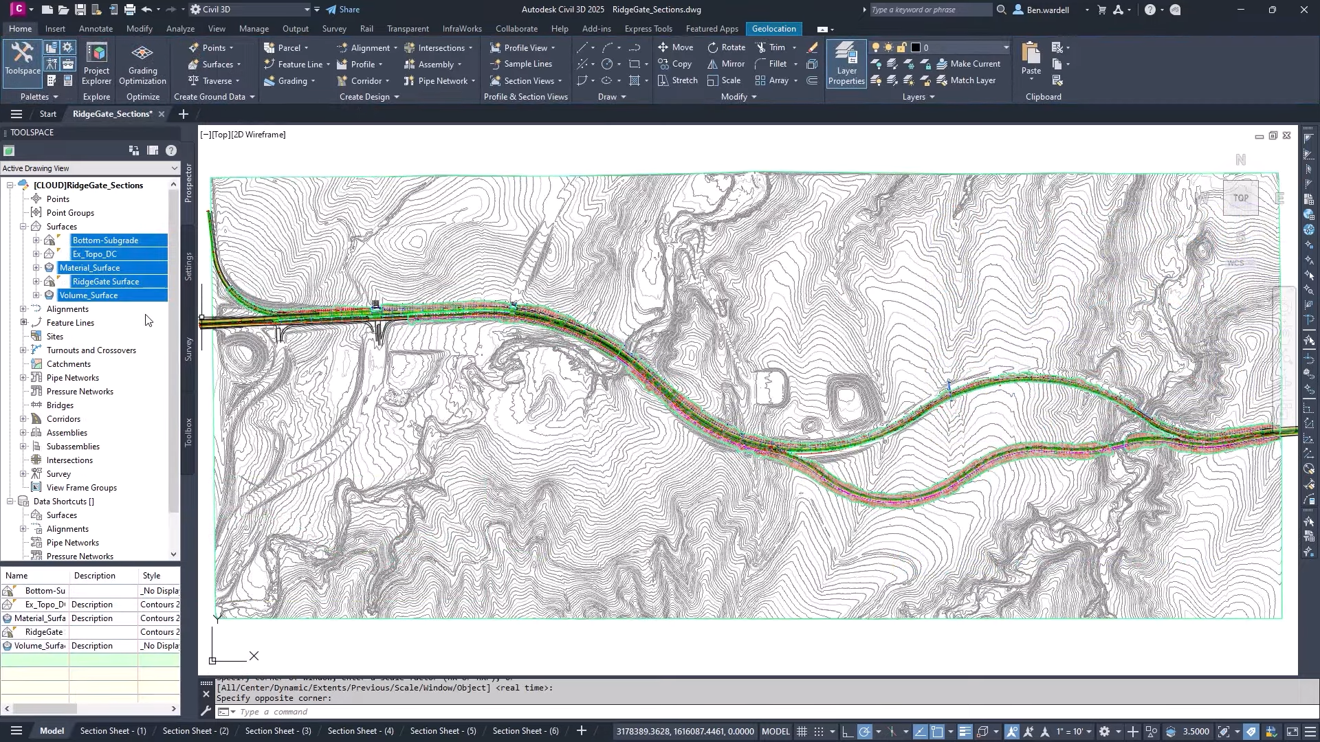
Civil 3D 2025: Improved performance. ©Autodesk