- File size:
- 230 MB
- Date added:
- Mar 30, 2023 | Last update check: 1 minute ago
- Licence:
- Trial | Buy Now
- Runs on:
- Windows 10 64-bit / 11 AutoCAD 2019 / 2020 / 2021 / 2022 / 2023
FARO As-Built for AutoCAD enables you to model as-built data across a variety of industry applications within your familiar AutoCAD design tools. It is solution for modeling of Captured Reality Data inside AutoCAD. You can combine it with all the well-known AutoCAD commands and it is very easy to learn if you are already an AutoCAD user.
FARO As-Built for AutoCAD replaced all products from FARO PointSense product family: the industry specific PointSense Building, PointSense Heritage, PointSense Plant and the industry neutral PointSense Pro, plus it includes additional features (functionality of other FARO AutoCAD plugins – PhoToPlan, TachyCAD, DistToPlan, hylasFM, MonuMap). PointSense Building is intended for generating 2D building plans (floor plans, sections and elevations) from 3D laser scan data. PointSense Heritage combines laser scanning and photogrammetry. It’s mainly meant for people working in archeology and preservation of historical sites. PointSense Plant is solution for intelligent plant design from laser scan data in AutoCAD.
Modeling of as-built data inside AutoCAD is a 3-step process:
- At first on site you capture scan data from different positions with laser scanners. PointSense Heritage enables you to collect your Point Clouds not only with laser scanners but also with photo cameras.
- In the office you can combine the individual scan positions into one common reference system and also pre-process scan data. You may use a pre-processing tool to clean and filter the raw scan data, like FARO SCENE.
- At the end, you do post-processing which means interpretation and modelling of Point Clouds. It can be done in a design tool like AutoCAD or Revit, using plugins As-Built for AutoCAD or As-Built for Revit. To get the data into AutoCAD and As-Built for AutoCAD you may directly export RCP/RCS files from FARO SCENE or you can also export E57 from any other scanner software. Or you can use Autodesk ReCap in order to create RCP or RCS point cloud files from your scan data.
Version 2022 updates (changelog)
- 2022.2 Update. Installs the HASP driver silently and suppresses error messages.
- 2022.1 Update. Improved the icons for the Exclude Clipping tools.
What’s new in version 2022.0:
- Support for AutoCAD 2023.
- Discontinued interfaces to the CAFM systems FAMOS and Archikart.
- Improved the tool for analyzing planes in a point cloud.
- Improved the flexibility of the “Floor and Room Height” command.
About FARO Technologies
FARO Technologies is a trusted source for 3D measurement, imaging and realization technology. It operates through 3D Manufacturing, Construction BIM, and Emerging Verticals. The company develops and markets computer-aided measurement and imaging devices and software for metrology, reverse engineering, factory automation, building information modeling, public safety, and other applications. Technology from FARO permits high-precision 3D measurement, imaging and comparison of parts within production and quality assurance processes.
FARO Technologies, Inc. was founded in 1981 and is headquartered in Lake Mary, Florida. The FARO software was firstly published in 2015, after FARO Technologies’ acquisition of Germany-based developer kubit GmbH.
Gallery
Learn how Clash Detection is used to identify interference between modeled objects within a point cloud environment.
FARO’s software for complete, efficient and cost effective Modeling of Captured Reality Data inside AutoCAD.
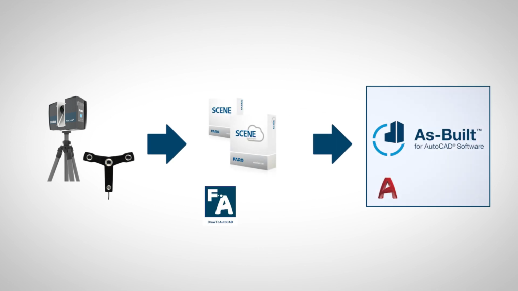
Modeling of as-built data inside AutoCAD is a 3-step process. ©FARO Technologies
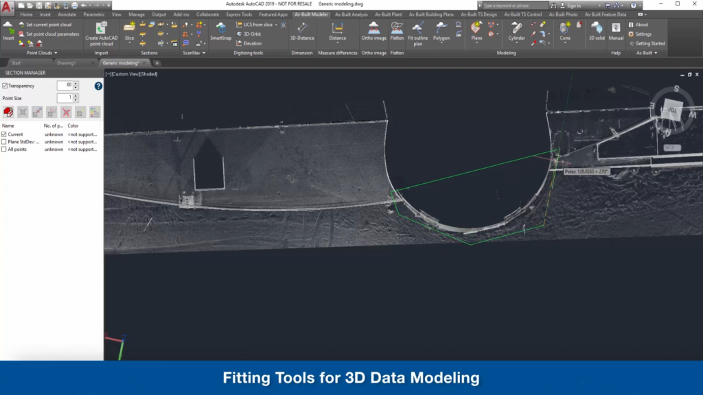
Fitting tools for 3D data modeling. ©FARO Technologies
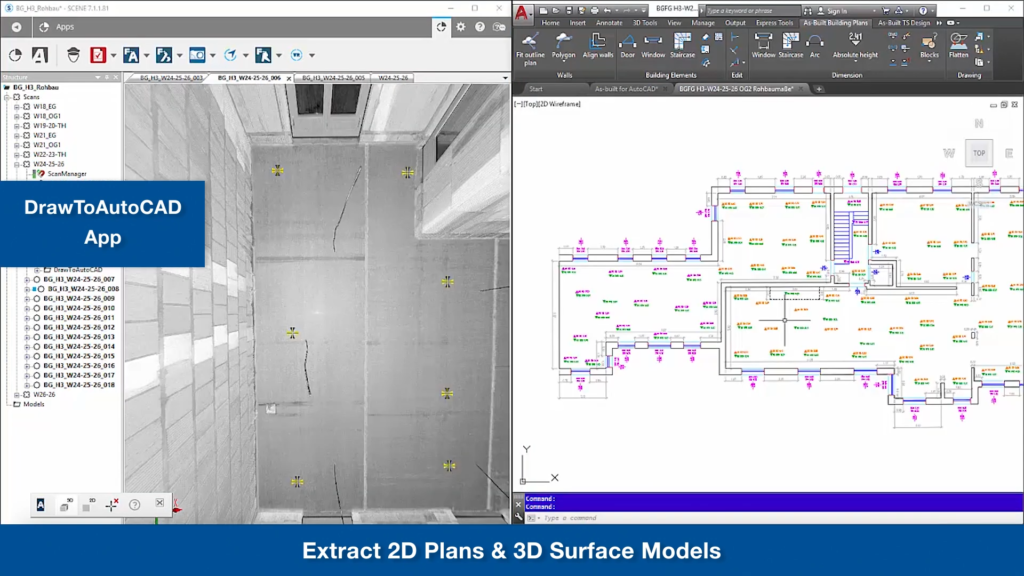
Extract 2D plans and 3D surface models. ©FARO Technologies
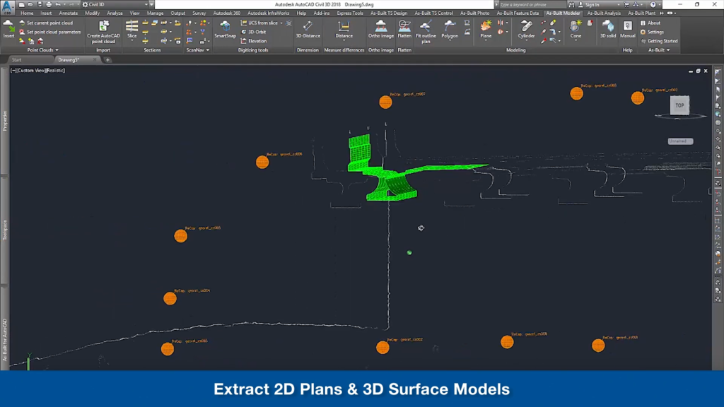
Extract 2D plans and 3D surface models. ©FARO Technologies
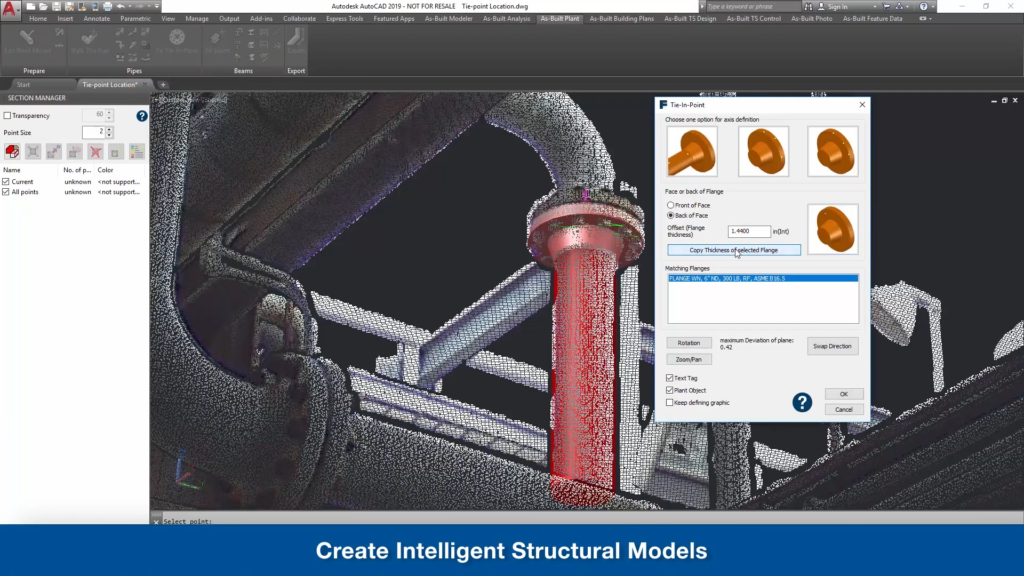
Create intelligent structural models. ©FARO Technologies
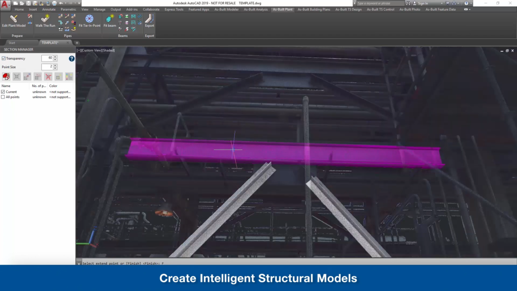
Create intelligent structural models. ©FARO Technologies
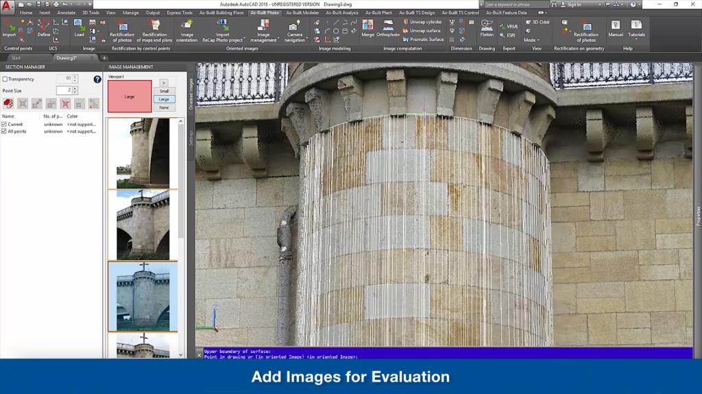
Add images for evaluation. ©FARO Technologies
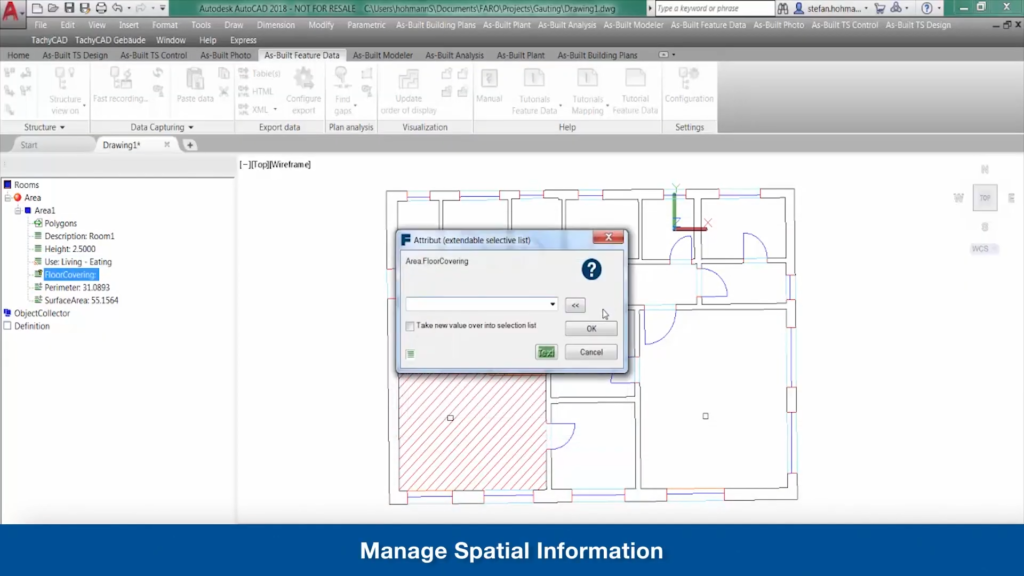
Manage spatial information. ©FARO Technologies
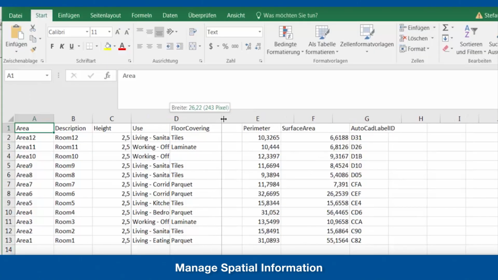
Manage spatial information. ©FARO Technologies
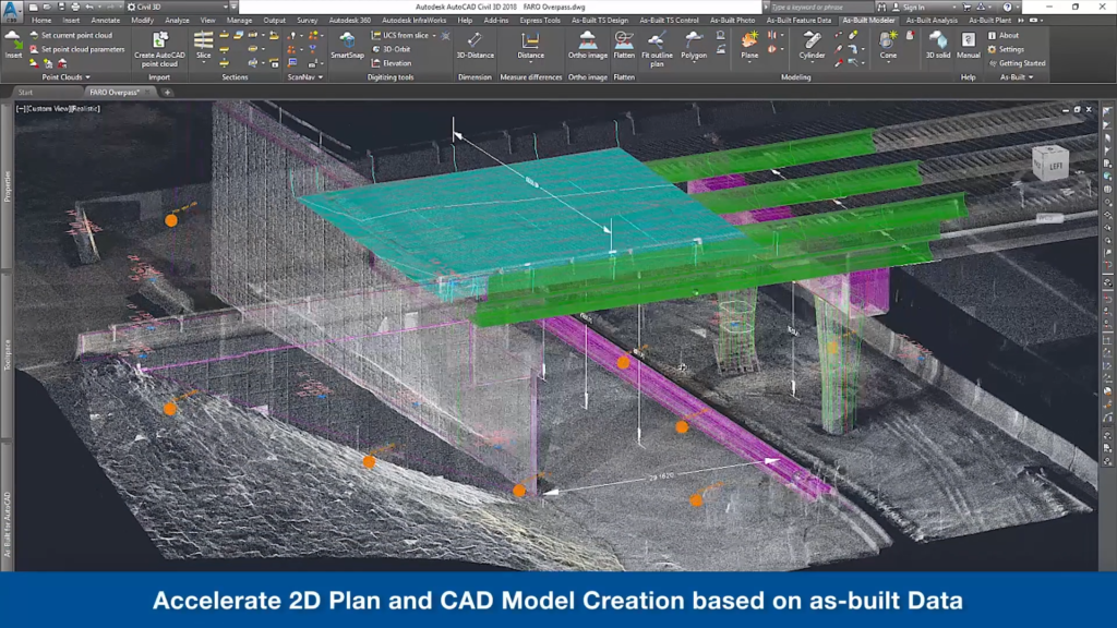
Accelerate 2D plan and CAD model creation based on as-built data. ©FARO Technologies