- File size:
- N/A
- Date added:
- Nov 19, 2021 | Last update check: 1 minute ago
- Licence:
- Trial
- Runs on:
- Web browser on your preferred gadget, tablet, laptop or PC.
NavVis IVION Core (formerly NavVis IndoorViewer) is a reality capture cloud-based software that allows users to capture and share the built environment as photorealistic digital twins. It is intended for laser scanning service providers, surveyors and AEC professionals.
NavVis IVION Core enables virtual access and interaction with scanned spaces through a web browser. The multi-site functionality lets you view and manage multiple projects in one space and from one account. You can get an overview of every project and easily navigate between buildings and sites. Create individual site coordinate systems for your projects. Upload, view and download data in a consistent local coordinate system for each individual site. Downloaded point clouds will immediately match corresponding BIM or CAD data when importing to third party software, optimizing registration workflows. User management system helps you manage projects with greater clarity and control. Set up user permissions for each site and manage stakeholder access on multiple levels.
NavVis IVION Core can be used with NavVis VLX, a mobile mapping system for both outdoor and indoor sites that can scan with high speed and accuracy. Together, they offer a complete mobile mapping solution for the built environment.
Features:
- Manage multiple projects and sites from central dashboard.
- Visually inspect point clouds to control the quality of the point cloud.
- Publish and share scan data online using a web browser.
- Select your own site coordinate system for survey-grade geo-registration of data.
- Publish the scans as a link and convert point clouds into immersive 360° images.
- Easily add geo-tagged information and media to 3D scans. Add and view this information as points of interest.
NavVis IVION Core is an integral component of the NavVis IVION product family.
About NavVis IVION
NavVis IVION is a platform for spatial data that allows you to turn your reality capture data into a digital twin for smart collaboration and decision making. It allows owners, operators and contractors to transform buildings and assets into intelligent spaces. NavVis IVION is a suite of products that includes:
- NavVis IVION Core. A reality capture platform designed for surveying and AEC industry.
- NavVis IVION Enterprise. For stakeholders in manufacturing industries to interact with realistic digital twins of their factories.
- NavVis IVION Go. App for iOS and Android devices to extend NavVis IVION Enterprise on a mobile device.
NavVis IVION Core integrations
NavVis IVION is integrated with Autodesk Construction Cloud, specifically BIM 360 and Autodesk Build, which improves construction management workflows. Compare and exchange as-build information with the BIM model.
NavVis IVION Add-In for Autodesk Revit connects Revit models to 360° imagery and point clouds displaying the current state of the building, which improves BIM workflows. You can create BIM models faster, compare as-built with as-is, spot differences visually, verify measurements, collaborate with stakeholders online.
Input/output formats includes E57, PLY, XYZ, PTS, PTX.
About Reality Capture
Using a high-definition laser scanner you can capture a digital 3D representation of a subject from the real world. This type of scanner is known as a LiDAR scanner. It uses light detection and ranging to capture the precise measurements along with high resolution color photos to capture the true environment. As an end product multiple of these scans are stitched together to create what is known as a 3D point cloud. This point cloud is required when you design new spaces with existing conditions to contend with.
About Scan-to-BIM
Scan-to-BIM refers to the process of 3D laser scanning a physical space or site, to create an accurate digital representation of it. That representation can then be used for designing, assessing progress, evaluating options, construction verification, as-built modeling.
To capture a digital representation of a space, a laser within the scanner case rotates at high speed. As the invisible laser beam hits various objects or materials, their position relative to the scanner and to other elements of your site or building is recorded as a piece of digital data – this is known as a “point”. When several of these points are collected they begin to build a highly accurate 3D digital picture of the space or site being scanned. A large collection of these points is commonly referred to as “point cloud”.
With your scan complete, the data captured can be taken out of the scanner on a simple USB drive. For most scanners you will need to open the raw scan data in a software that calibrates it before it is ready for sharing with others or for importing into design authoring software or into your project’s common data environment (CDE).
About NavVis
NavVis was founded in 2013 with mission to bring spatial intelligence to every building. NavVis develops solutions that bridge the gap between the physical and digital world. As a spin-off of the Technical University of Munich, their computer vision based indoor positioning technology is based on years of academic research. Their digital twin platform is being used by the automotive, construction, real estate and insurance companies. They have over 100 partners in more than 30 countries worldwide deploying their technology.
NavVis is headquartered in Munich and has offices in New York and Shanghai, currently employing over 165 people across the globe.
Gallery
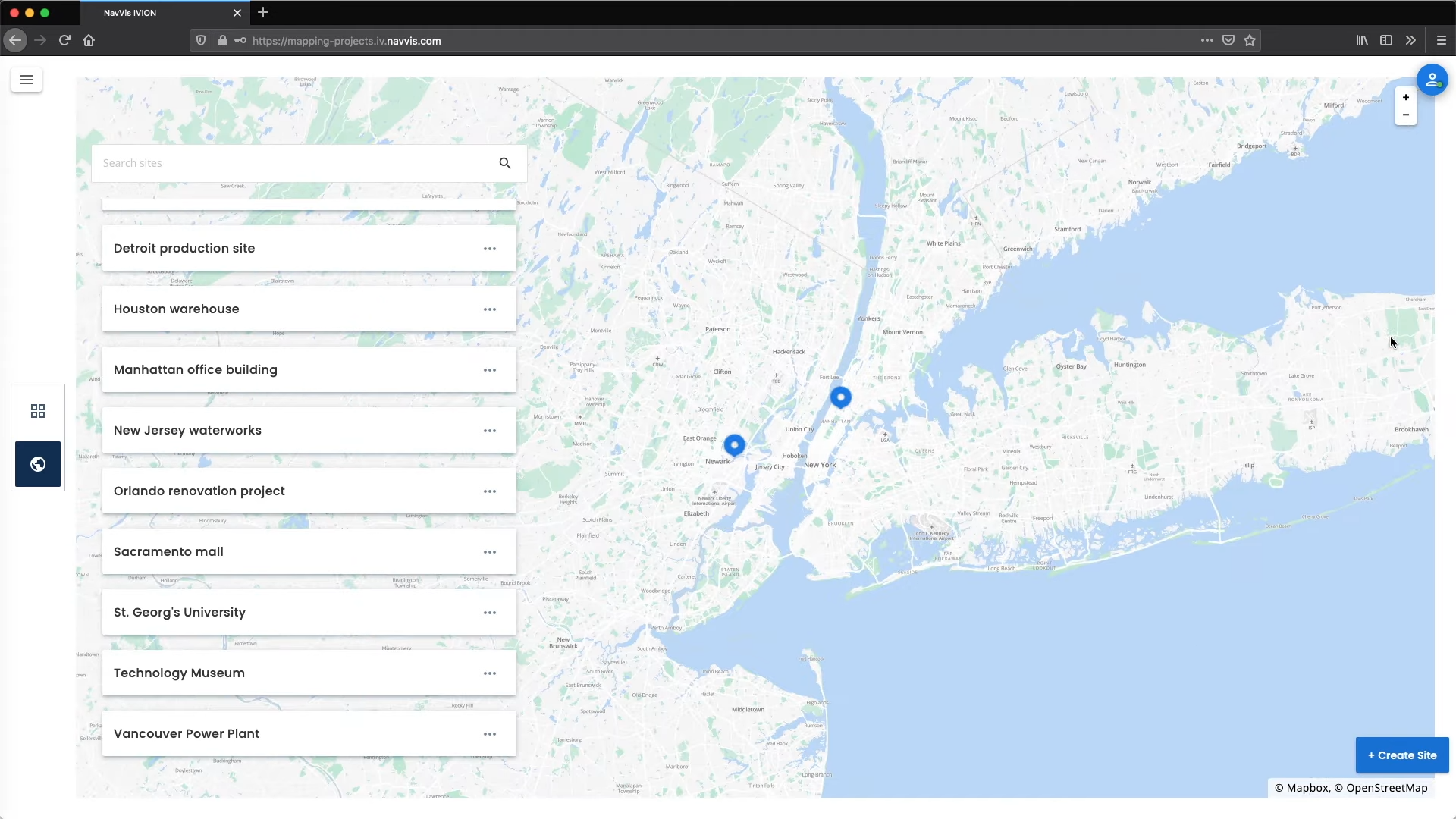
Get overview of every project and navigate between buildings and sites. ©NavVis
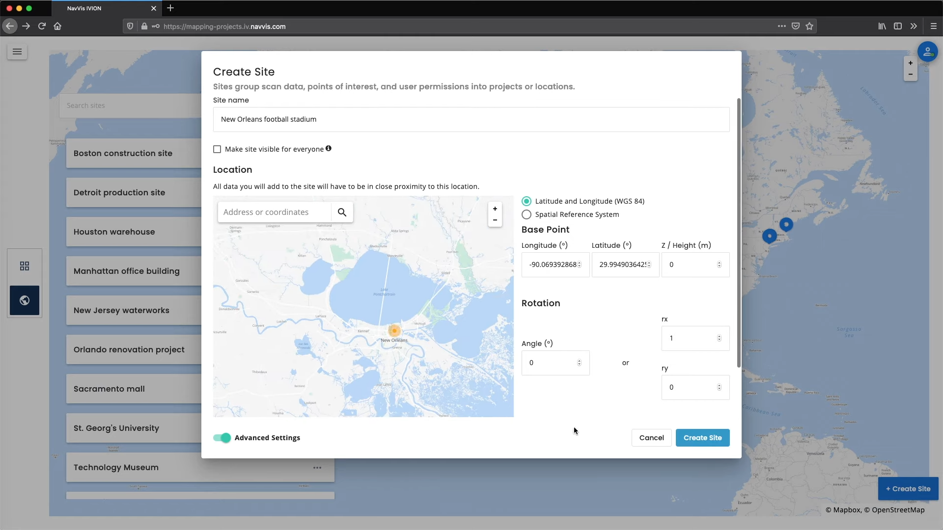
Create Site. Sites group scan data, points of interest, and user permissions into projects or locations. ©NavVis
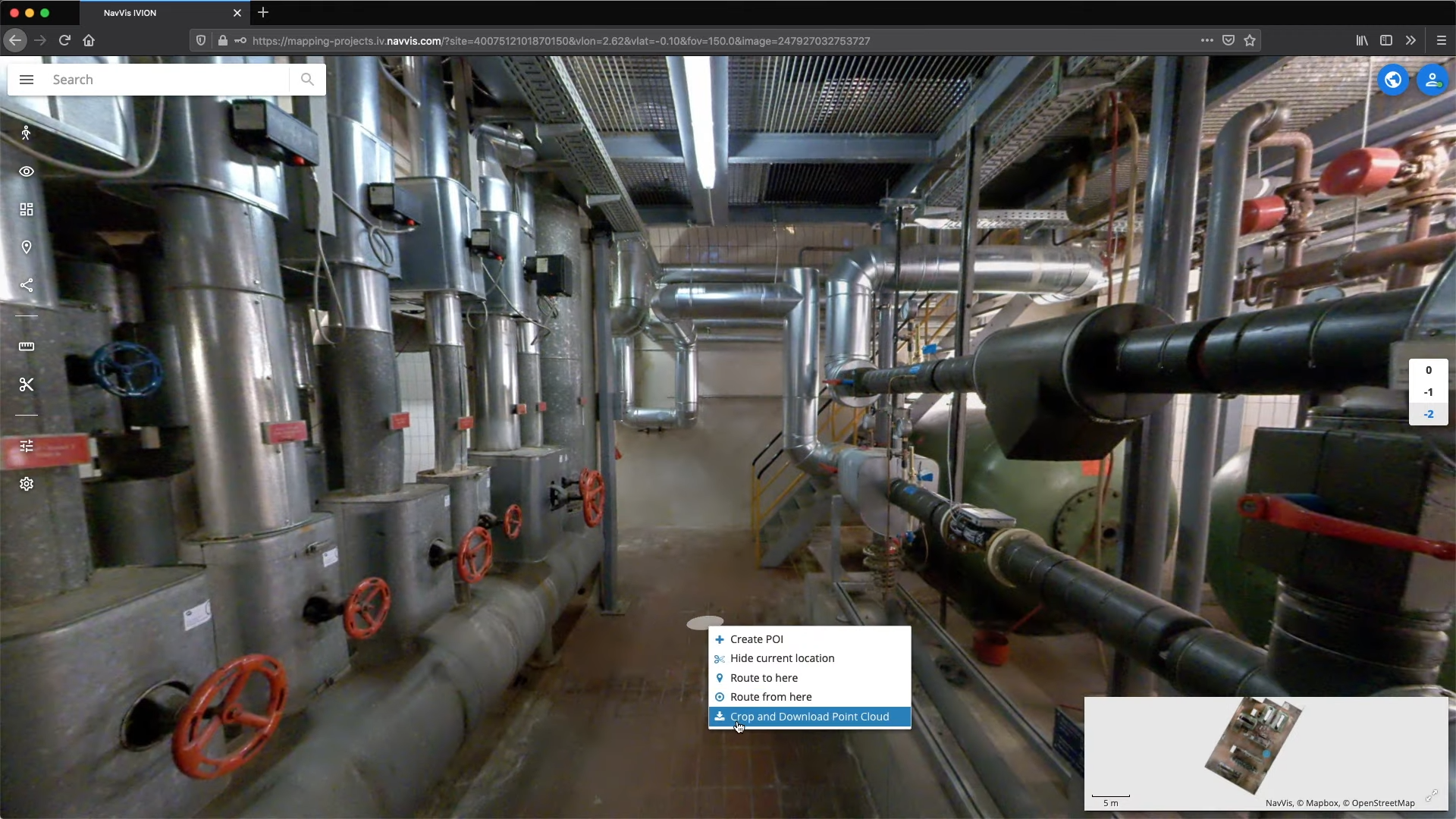
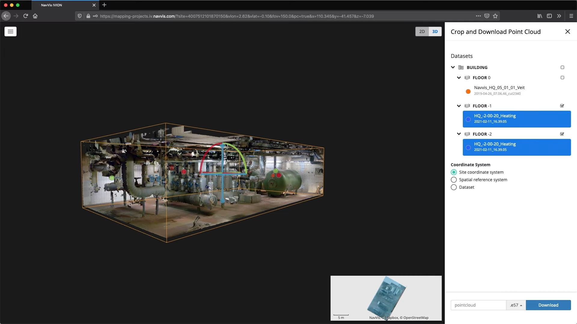
Crop and download point cloud. ©NavVis
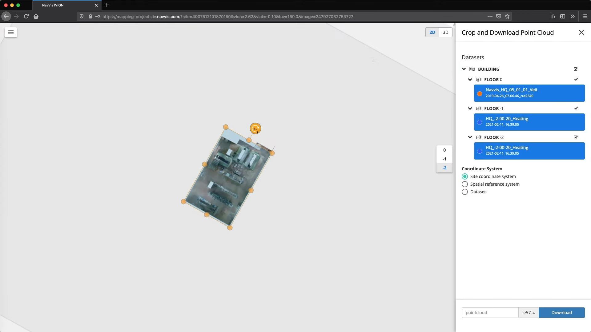
Crop and download point cloud. ©NavVis
Crop and download point cloud. ©NavVis
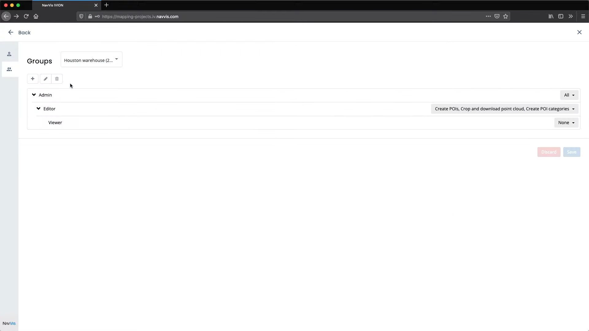
User Management – Groups. ©NavVis
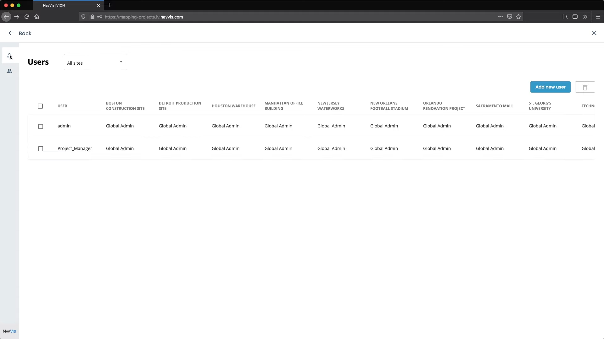
User Management – Users. ©NavVis
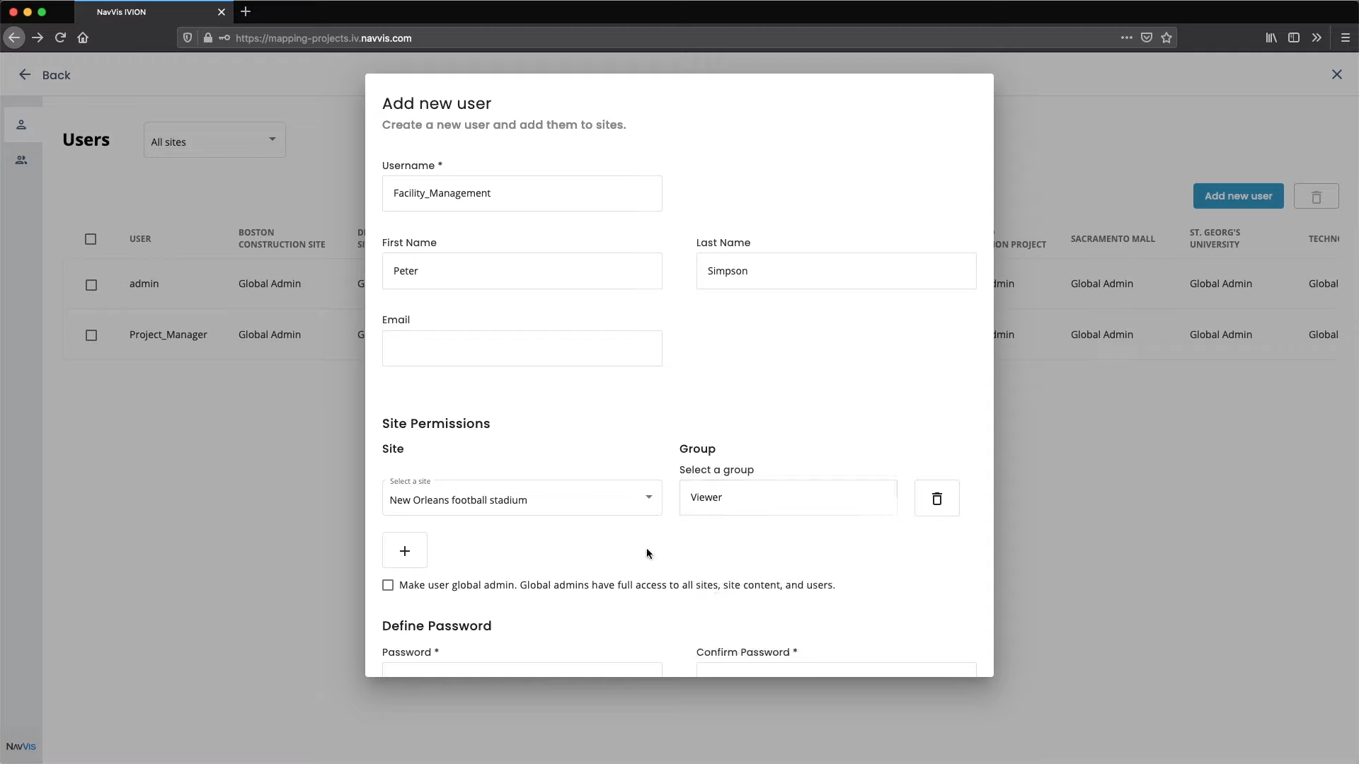
User Management – Users. Craete a new user and add them to sites. ©NavVis