- Date added:
- Feb 18, 2023 | Last update check: 1 minute ago
- Integrations:
- —
- Licence:
- Freeware
- Runs on:
- Revit 2018 / 2019 / 2020 / 2021 / 2022
PointKit (PointCloud toolkit) for Revit is a free add-on that improves your productivity when working with Point Clouds. It is a set of helpful utility tools that will help users to speed the daily modelling jobs, easily control the visibility of points, transfer points to Family templates, etc.
Note: starting with Revit 2023, PointKit is part of DiRootsOne and is no more available as a standalone product.
The add-on includes the following commands:
- Import DXF File
- Import DXF File
- Import ASCII point cloud file
- Export
- Select Points
- Select Points
- Select Between Levels
- Undo
- Redo
- Reset
Features:
- Region selection that allows user to isolate in multiple views.
- Selection by levels.
- Custom Undo/Redo system that will record up to 30 selection actions and enable the user to walk through select actions.
- Export visible set of points from point cloud to XYZ, PTS, or DXF files and open it in a Revit family environment (RFA).
- Define point cloud density while exporting.
- Re-mesh exported points and save to DXF file.
About Reality Capture
Using a high-definition laser scanner you can capture a digital 3D representation of a subject from the real world. This type of scanner is known as a LiDAR scanner. It uses light detection and ranging to capture the precise measurements along with high resolution color photos to capture the true environment. As an end product multiple of these scans are stitched together to create what is known as a 3D point cloud. This point cloud is required when you design new spaces with existing conditions to contend with.
About Scan-to-BIM
Scan-to-BIM refers to the process of 3D laser scanning a physical space or site, to create an accurate digital representation of it. That representation can then be used for designing, assessing progress, evaluating options, construction verification, as-built modeling.
To capture a digital representation of a space, a laser within the scanner case rotates at high speed. As the invisible laser beam hits various objects or materials, their position relative to the scanner and to other elements of your site or building is recorded as a piece of digital data – this is known as a “point”. When several of these points are collected they begin to build a highly accurate 3D digital picture of the space or site being scanned. A large collection of these points is commonly referred to as “point cloud”.
With your scan complete, the data captured can be taken out of the scanner on a simple USB drive. For most scanners you will need to open the raw scan data in a software that calibrates it before it is ready for sharing with others or for importing into design authoring software or into your project’s common data environment (CDE).
What’s new in version 1.0.0:
This is initial release.
Gallery
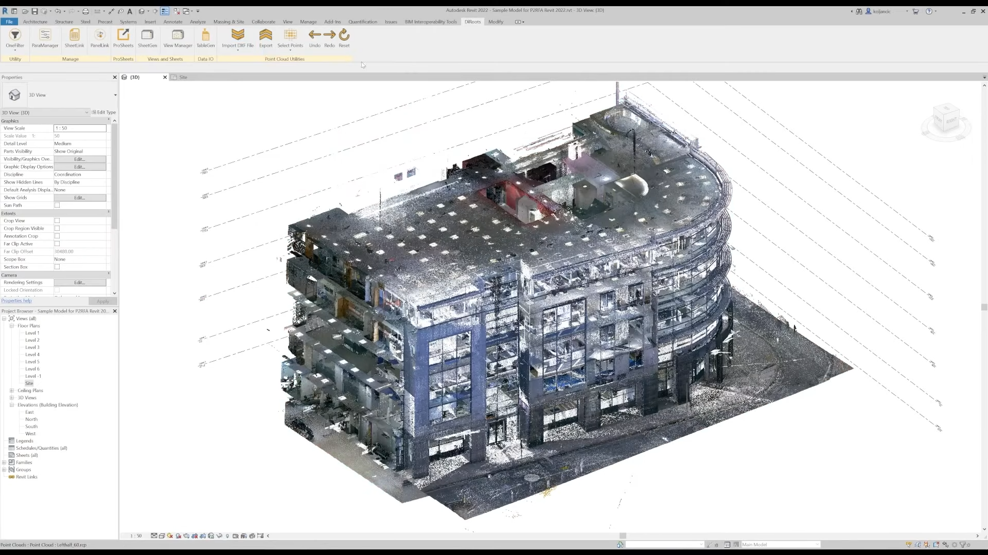
PointKit ribbon in Revit. ©DiRoots
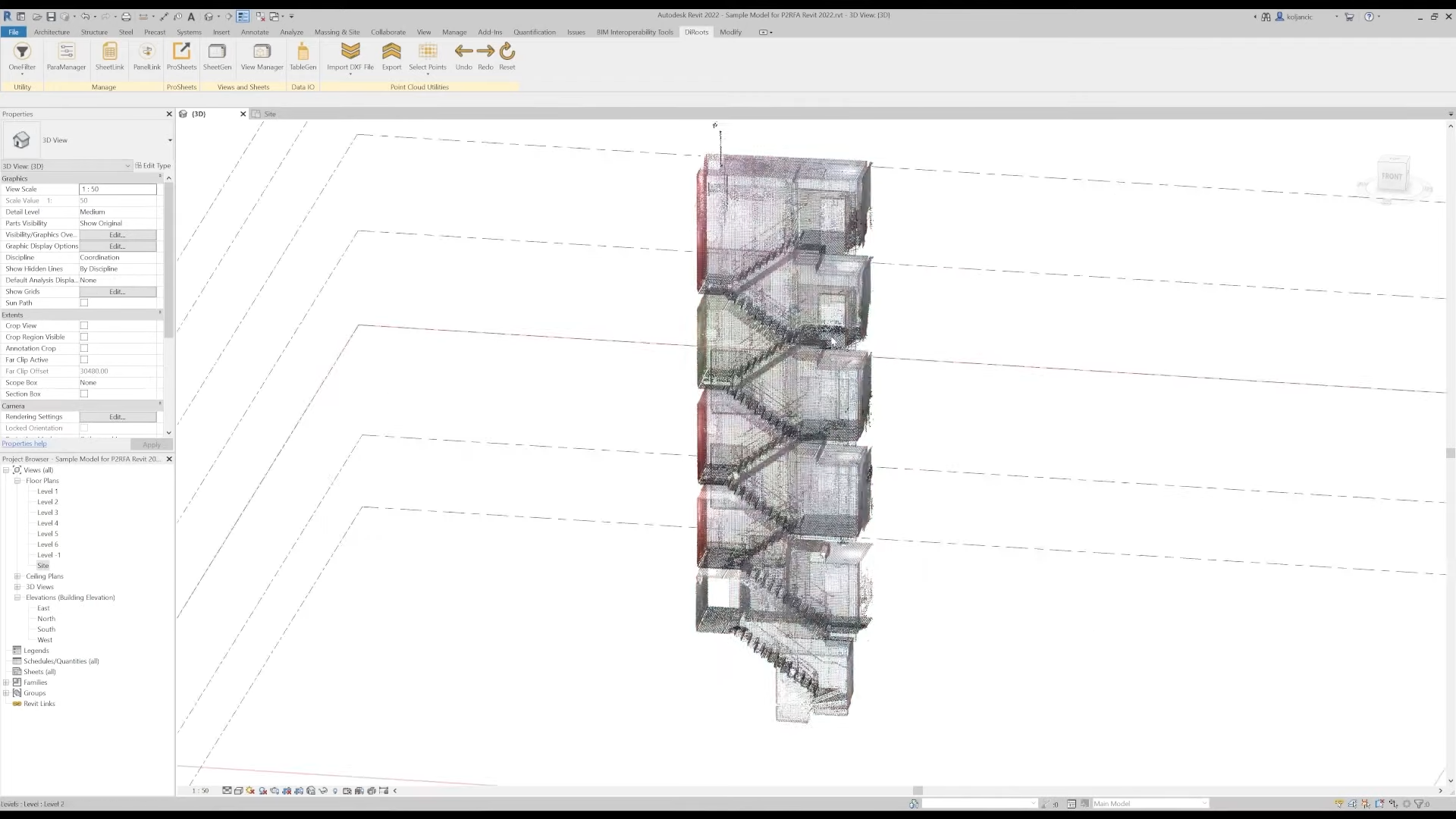
Control the visibility of points. ©DiRoots
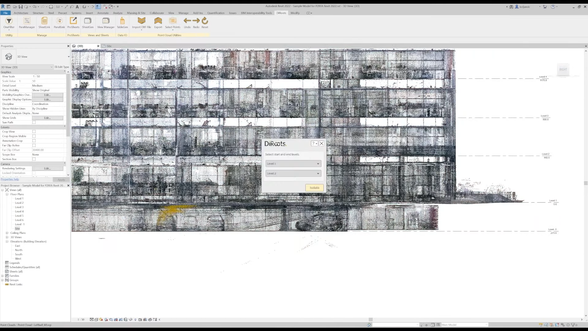
Select points between levels. ©DiRoots