- File size:
- 63.6 MB
- Date added:
- Jan 12, 2020 | Last update check: 1 minute ago
- Licence:
- Freeware
- Runs on:
- Navisworks Manage 2017 / 2018 / 2019 / 2020 Navisworks Simulate 2017 / 2018 / 2019 / 2020
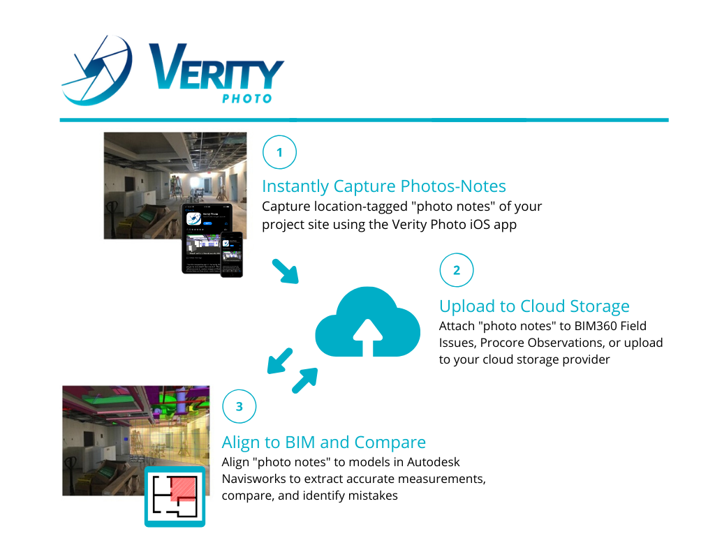
Verity Photo is a construction verification software that allows you to verify installed work by aligning digital photos of an active construction site with 3D coordinated models in Autodesk Navisworks. It enables users to snap photos of a project site, align them to a coordination model in Navisworks, and identify mistakes/misalignments onsite before they become expensive problems. This makes the software a convenient, highly accessible verification tool that can be used as an alternative to 3D laser scanning. Some of the benefits include:
- Extract accurate measurements from mixed reality views in minutes
- Reduce the need for large data transfers & expensive equipment
- Conveniently track the progress of your projects
- Instantly document observed construction issues
- Identify problems earlier in the construction process
Verity Photo consists of two applications: Navisworks plugin and iOS app. There is no app for Android. You can download the Verity Photo app for free and integrate it with Autodesk Navisworks for less than a dollar per day.
Typical workflow:
-
- Install the Verity Photo Navisworks Plugin
- Export a MAP file
-
- Install and Calibrate the Verity Photo app
- Import a MAP file
- Capture a photo note
-
- Align a note in Navisworks
- Perform measurements on an image
- Overlay notes on a map
For more information please visit https://www.clearedge3d.com/support/verityphoto/.
About ClearEdge3D
ClearEdge3D has a track record of technological innovation and thought leadership in the Automated Feature Extraction, laser scanning and 3D modeling space. The company was founded in 2006 by recognized experts in the field of computer vision, hyperspectral data analysis, and LiDAR data analysis. ClearEdge3D is headquartered in Manassas, Virginia.
In February 2018, ClearEdge3D was acquired by Topcon.
Gallery
Verity Photo Overview – clearedge3d.com
clearedge3d.com
clearedge3d.com
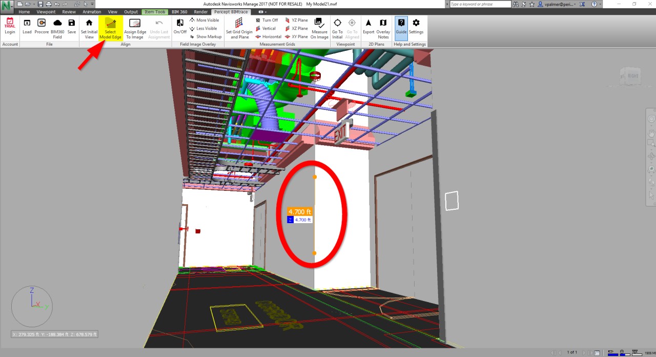
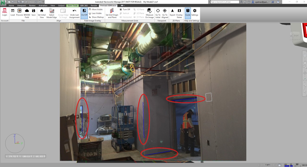
In order to align the Navisworks camera to match the perspective of the note image, you’ll need to tell Verity Photo what edges in the model correspond to what lines in the note image. You’ll need to specify at least four of these model-image assignments to complete an alignment – clearedge3d.com
clearedge3d.com
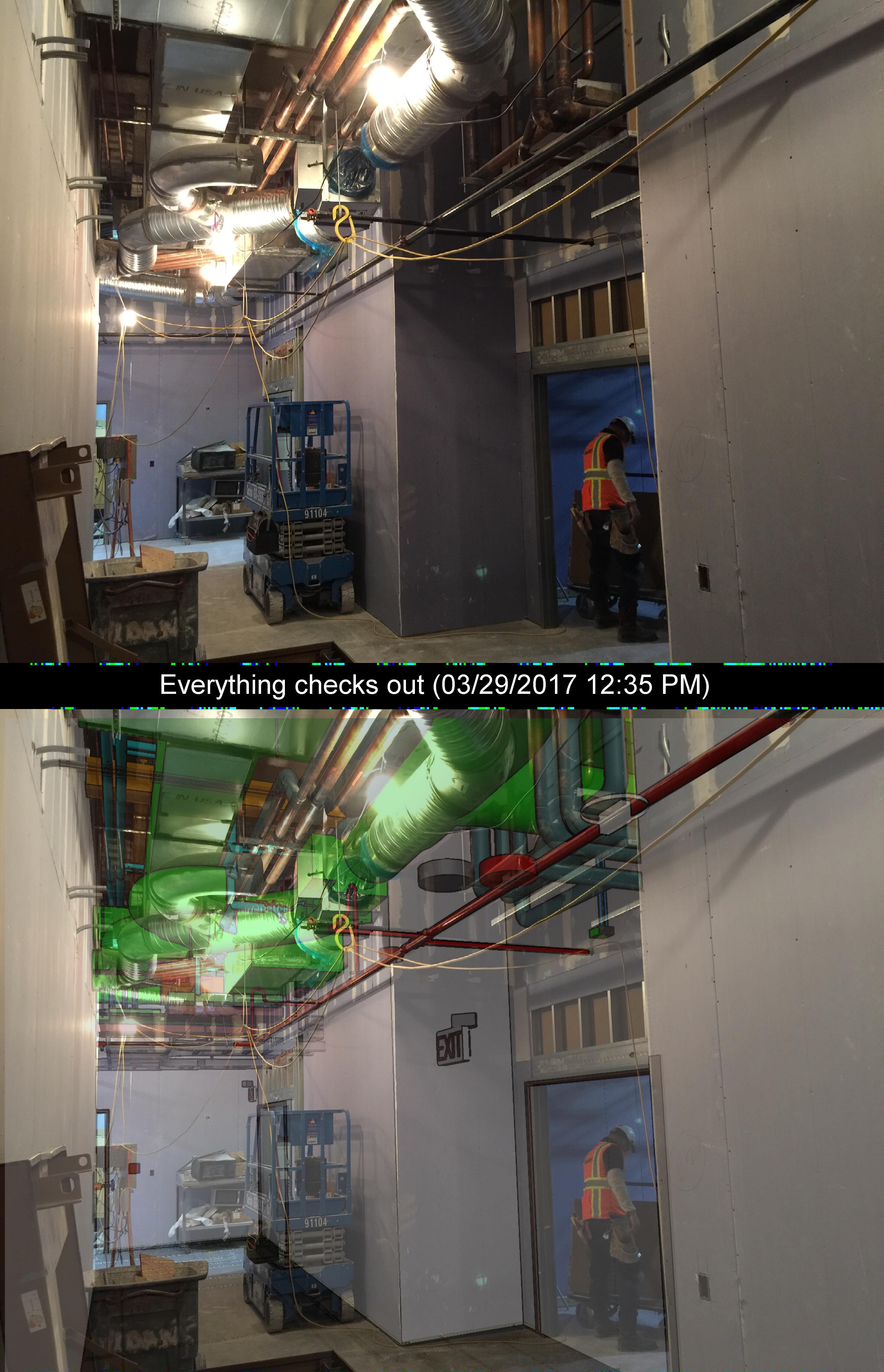
The final note will contain the original camera image and the overlay as it appears in the Navisworks window – clearedge3d.com
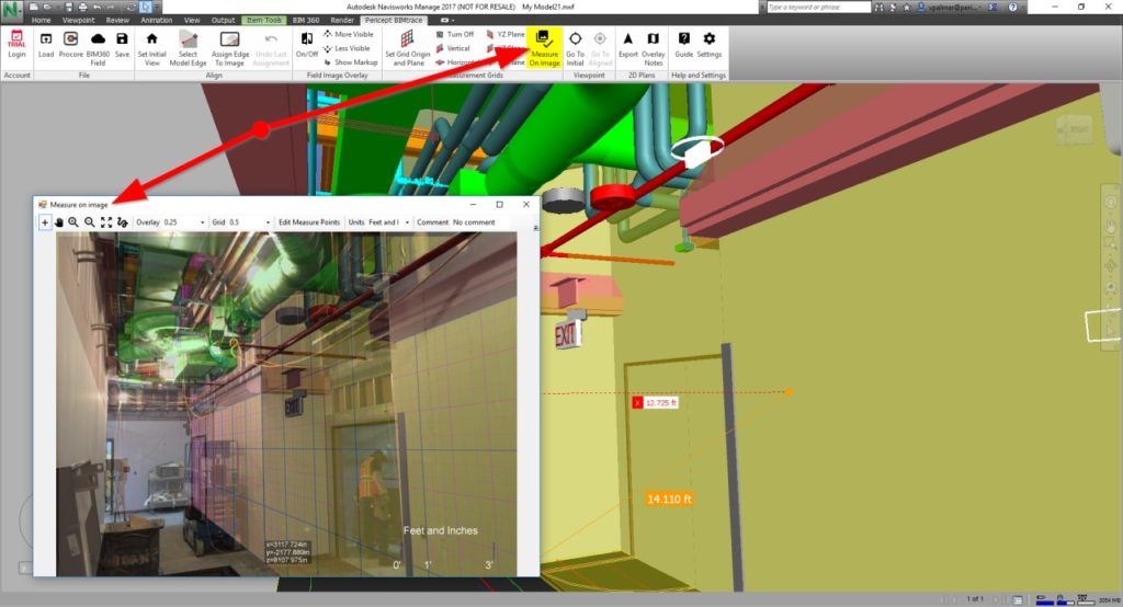
Once Verity Photo notes are aligned to a model, it’s possible to perform 3D measurements directly on the image by using the model for reference – clearedge3d.com
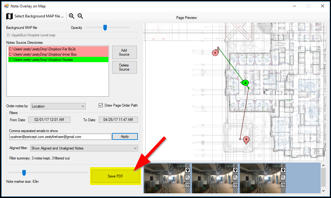
You can use Verity Photo to display captured notes on an exported map and export this overlay to a PDF for easy distribution – clearedge3d.com
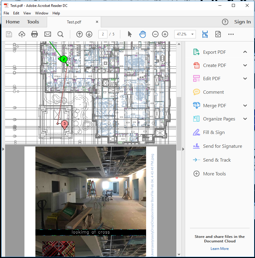
The resulting PDF has the following format:
- 1st page: Table of Contents listing the individual note sources and their colors.
- 2nd page: A rendering of the map with note overlays. Each note marker is hyperlinked to its corresponding note image on the subsequent pages.
- Rest of the pages: Each page is a single note image that was plotted on the map.
clearedge3d.com