- File size:
- N/A
- Date added:
- Sep 07, 2021 | Last update check: 1 minute ago
- Licence:
- Trial
- Runs on:
- WebGL-compatible browsers such as Google Chrome or Mozilla Firefox (Internet Explorer is not supported)
Cintoo Cloud is the cloud-based SaaS platform to make the reality data fully cloud and BIM compatible so that all stakeholders can collectively benefit from it and can collaborate in real time. By making this move to the cloud reality data not only becomes collaborative but it also benefits from cloud computing and machine learning for analysis.
Terrestrial laser scanners are getting cheaper and easier to use. The problem is that they produce gigantic datasets known as reality data that can only be used in desktop centric systems and by shipping on hard-disk. With Cintoo Cloud, you can turn a point cloud into surfaces that will make the reality data 15-20 times smaller in size before uploading to the cloud.
It is also much easier to view and to stream as a mesh using a simple Google web browser. With Cintoo Cloud, an inverse transformation is also possible. You can get back the reality data in its original form as a structured or unified point cloud without compromising the accuracy.
Typical workflow:
You can take the laser scan data after the registration as structured RCP thanks to the ReCap Software Development Kit (SDK) or E57 files. Cintoo Connect (available directly from Cintoo Cloud web app) is a Windows app that will run locally on your desktop to transform the point cloud into a surface mesh and to upload it to Cintoo Cloud. The reality capture data is now accessible by your team or your customers at anytime from anywhere using either Microsoft Azure or Amazon Web Services.
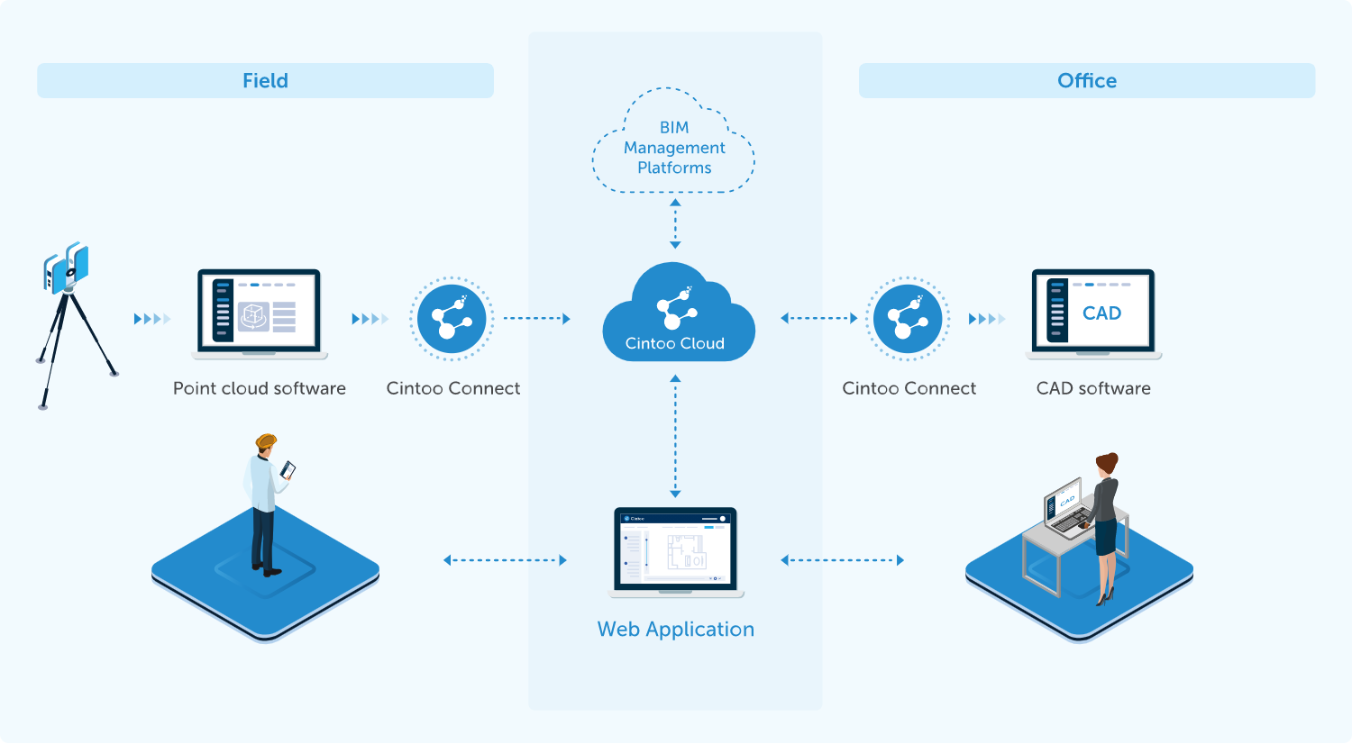
Cintoo Cloud supports the Scan-vs-BIM workflow using Autodesk BIM 360 interoperability. You can push the 3D BIM model (RVT, NWD, IFC, 3D DWG) from BIM 360 Docs to Cintoo Cloud and compare these models with scan data.
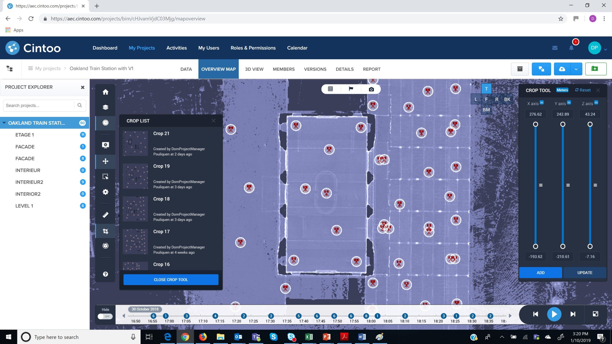
The other workflow that Cintoo Cloud supports is the Scan-to-BIM. Using the Cintoo Cloud web interface you can crop the data along any access, organize your scans and work zones and, using Cintoo Connect, you can export back this reality data as an unified RCS file or a structured E57 file for consumption in your BIM/CAD software such as Revit, AutoCAD or Navisworks.
About Reality Capture
Using a high-definition laser scanner you can capture a digital 3D representation of a subject from the real world. This type of scanner is known as a LiDAR scanner. It uses light detection and ranging to capture the precise measurements along with high resolution color photos to capture the true environment. As an end product multiple of these scans are stitched together to create what is known as a 3D point cloud. This point cloud is required when you design new spaces with existing conditions to contend with.
About SaaS
SaaS (Software as a Service) is a cloud-based service where you access an application via a web browser instead of installing the software on your PC. The cloud runs a single instance of the software and makes it available for multiple end-users. This makes cloud computing cheap. All the computing resources responsible for delivering SaaS are entirely managed by the vendor.
What’s new in version 2.1:
- Connection to BIM 360 Docs.
- Comparison tools between the mesh-based scan data and the BIM model. Detected issues can be exported in BCF format.
About Cintoo
Cintoo develops technologies and solutions for managing and leveraging the 3D data coming from Reality Capture devices in the cloud. Spin-off from I3S Lab (joint Lab between the University of Sophia-Antipolis and CNRS, Southern France), Cintoo was created in July 2013. Cintoo’s innovation relates into various algorithms that constitute a major breakthrough for the 3D community, and which make a unique offering in the AEC and Infrastructure industries. Cintoo co-founders are now joined by experienced professionals coming from the industries that the company is targeting for its worldwide development.
Gallery
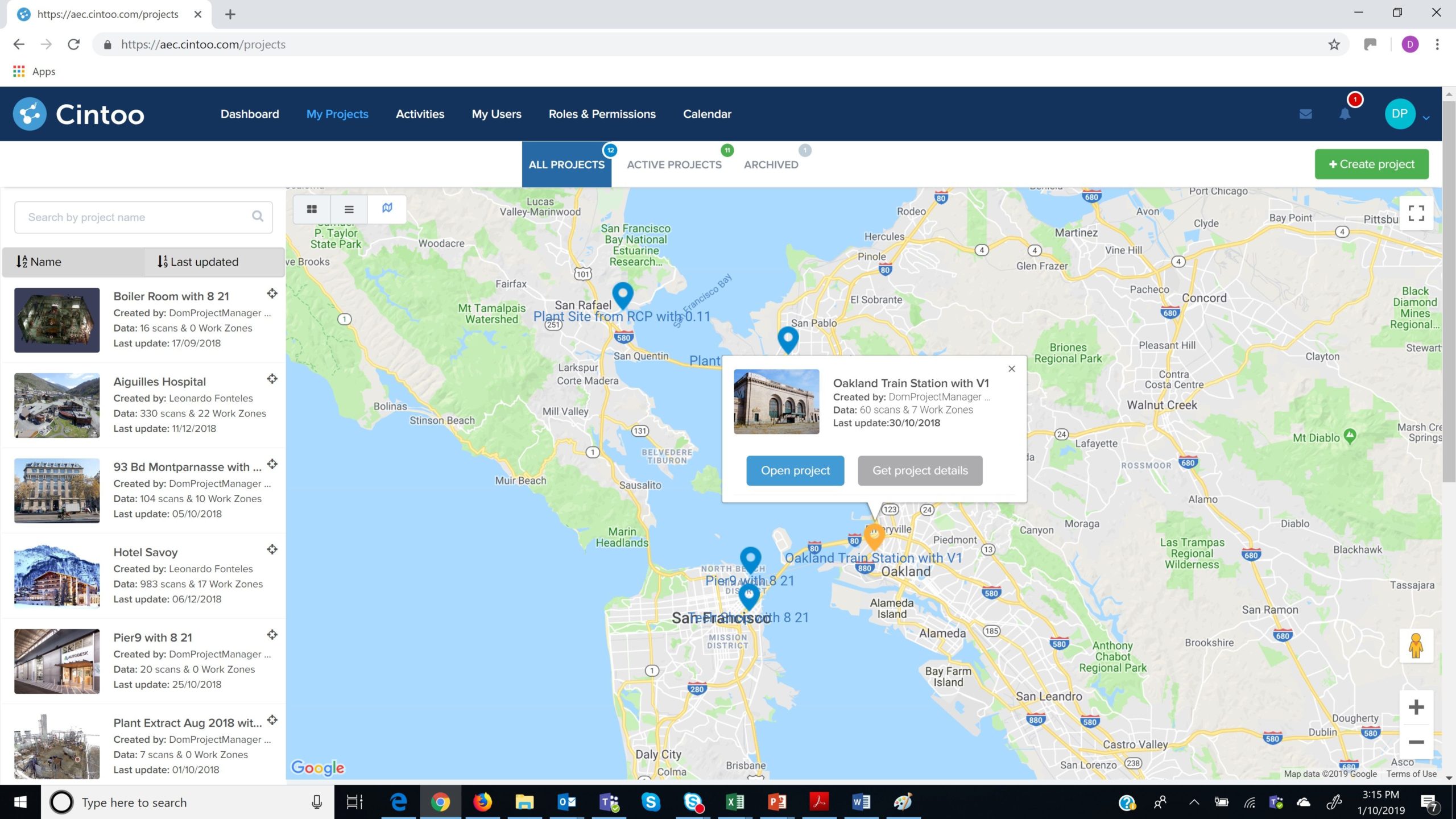
Managing scan projects via a map ©apps.autodesk.com
Overlay of the BIM model to the scan data in Cintoo Cloud viewer (courtesy of AGP, France) ©apps.autodesk.com
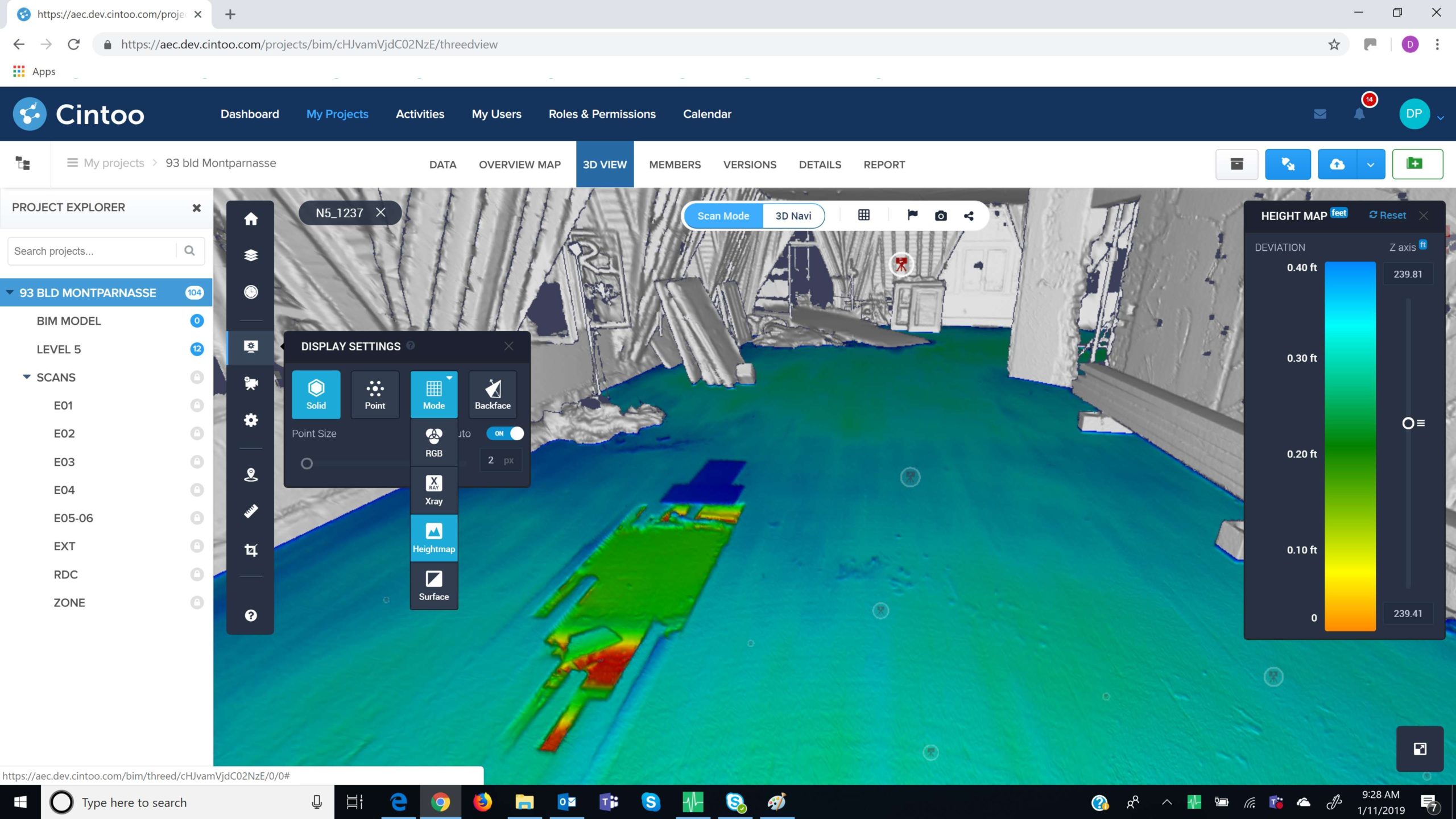
Using the Height Map display mode to visually check the floor flatness (courtesy of AGP, France) ©apps.autodesk.com
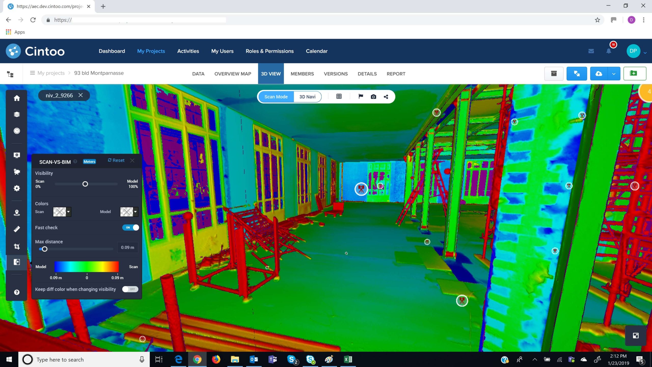
Comparing scan data to a BIM model in Cintoo Cloud (courtesy of AGP, France) ©apps.autodesk.com
©apps.autodesk.com
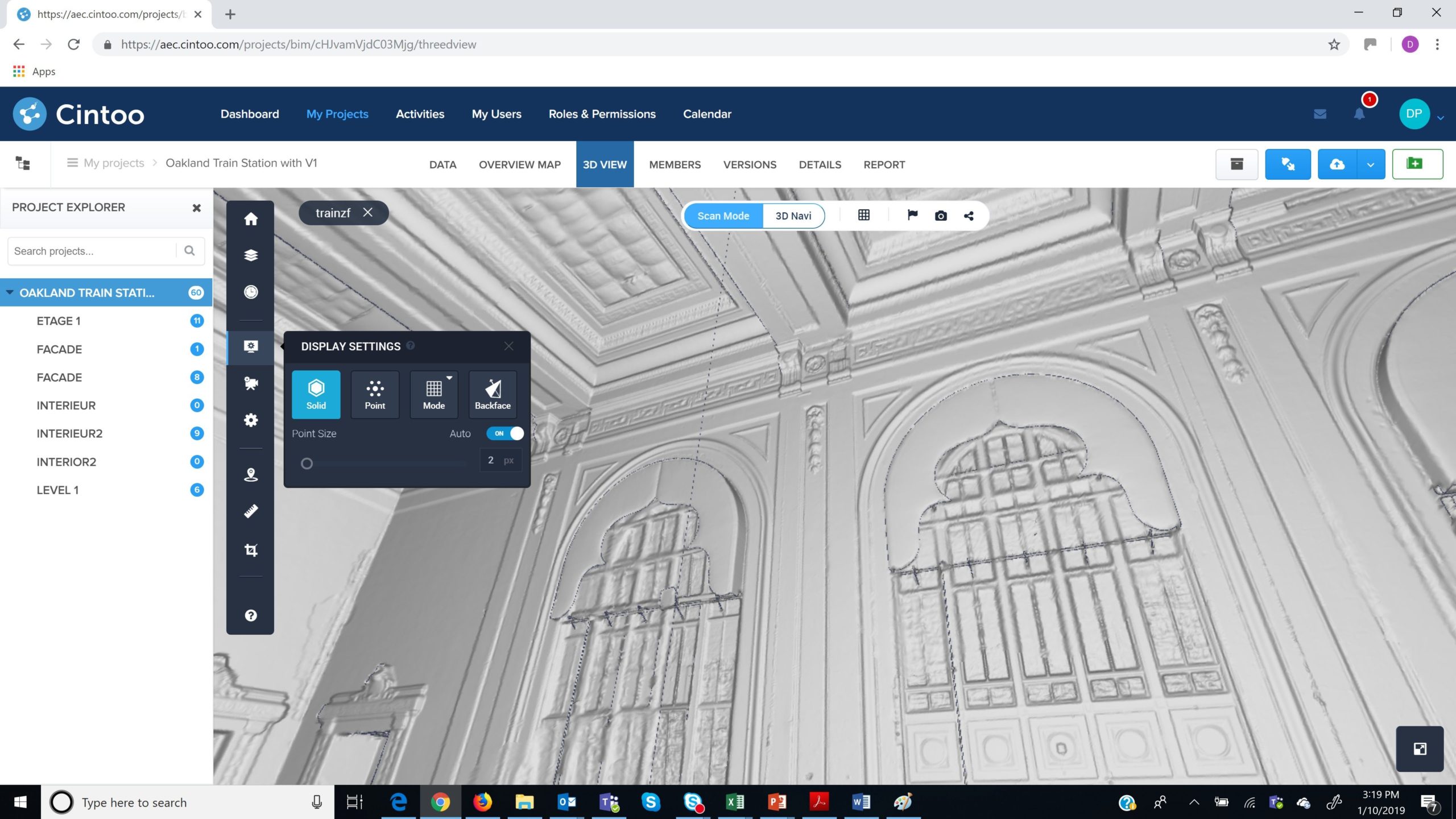
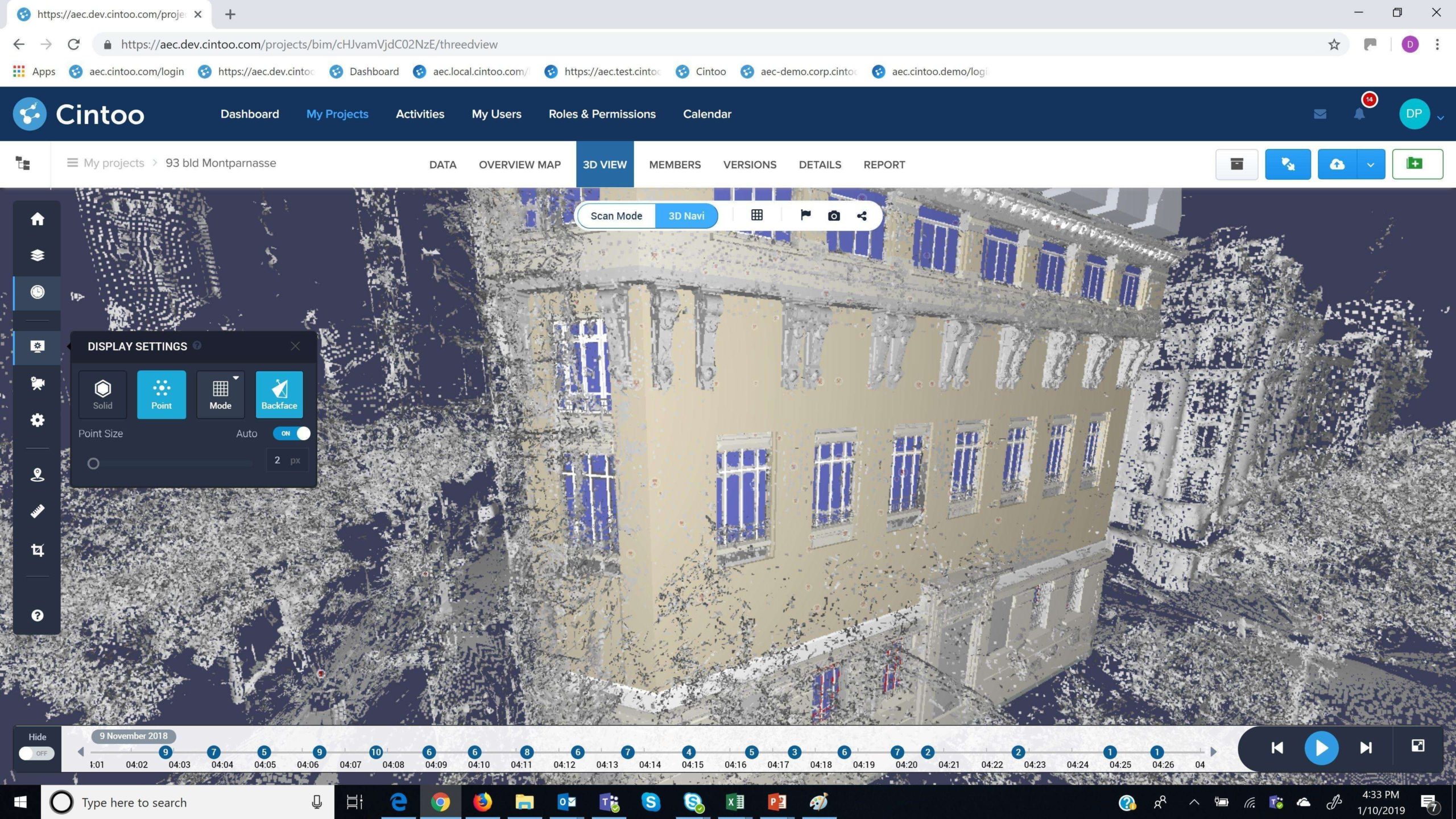
Cintoo Cloud mesh-based 3D scan view ©apps.autodesk.com
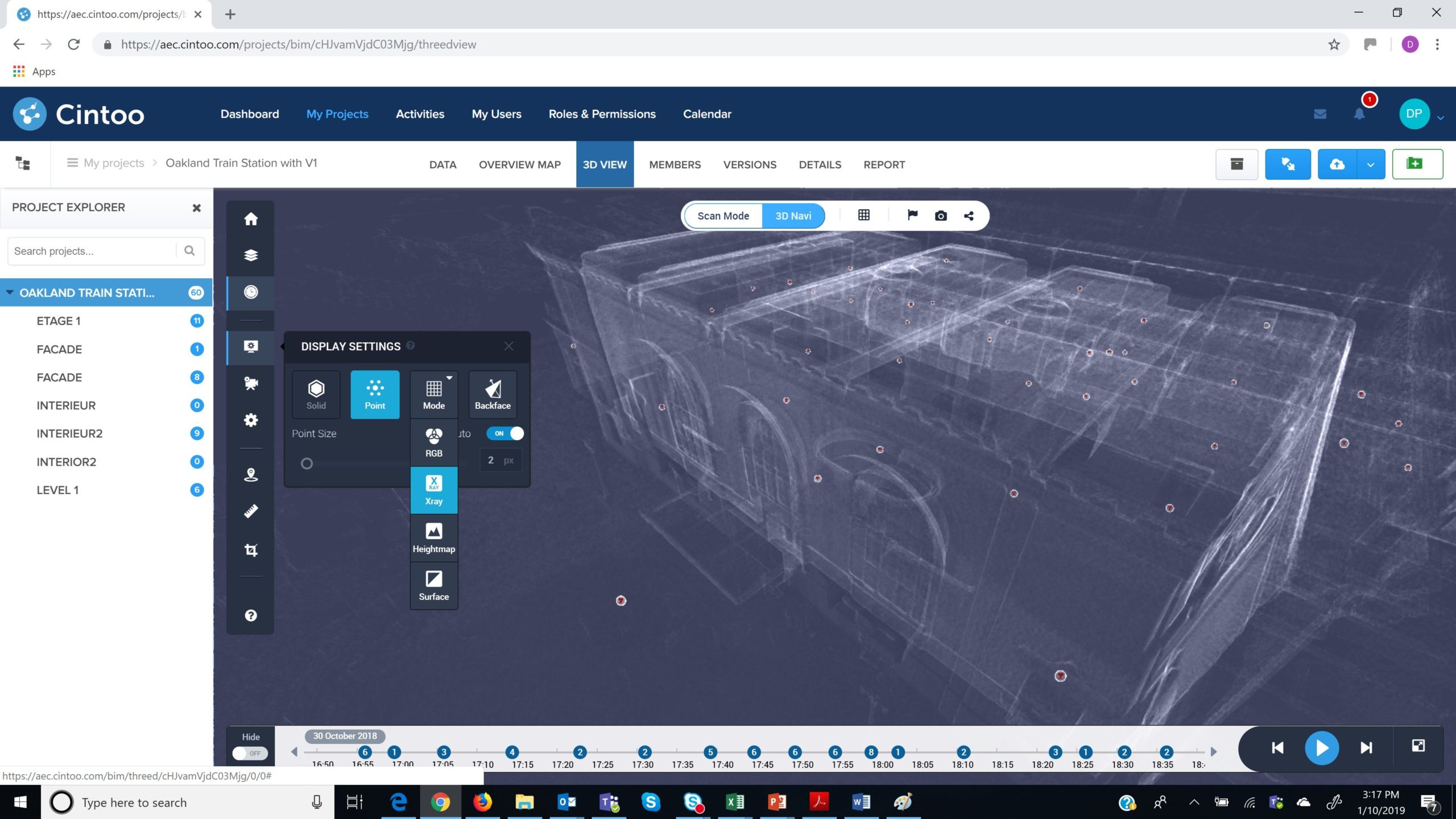
Cintoo Cloud 3D View in X Ray display mode ©apps.autodesk.com
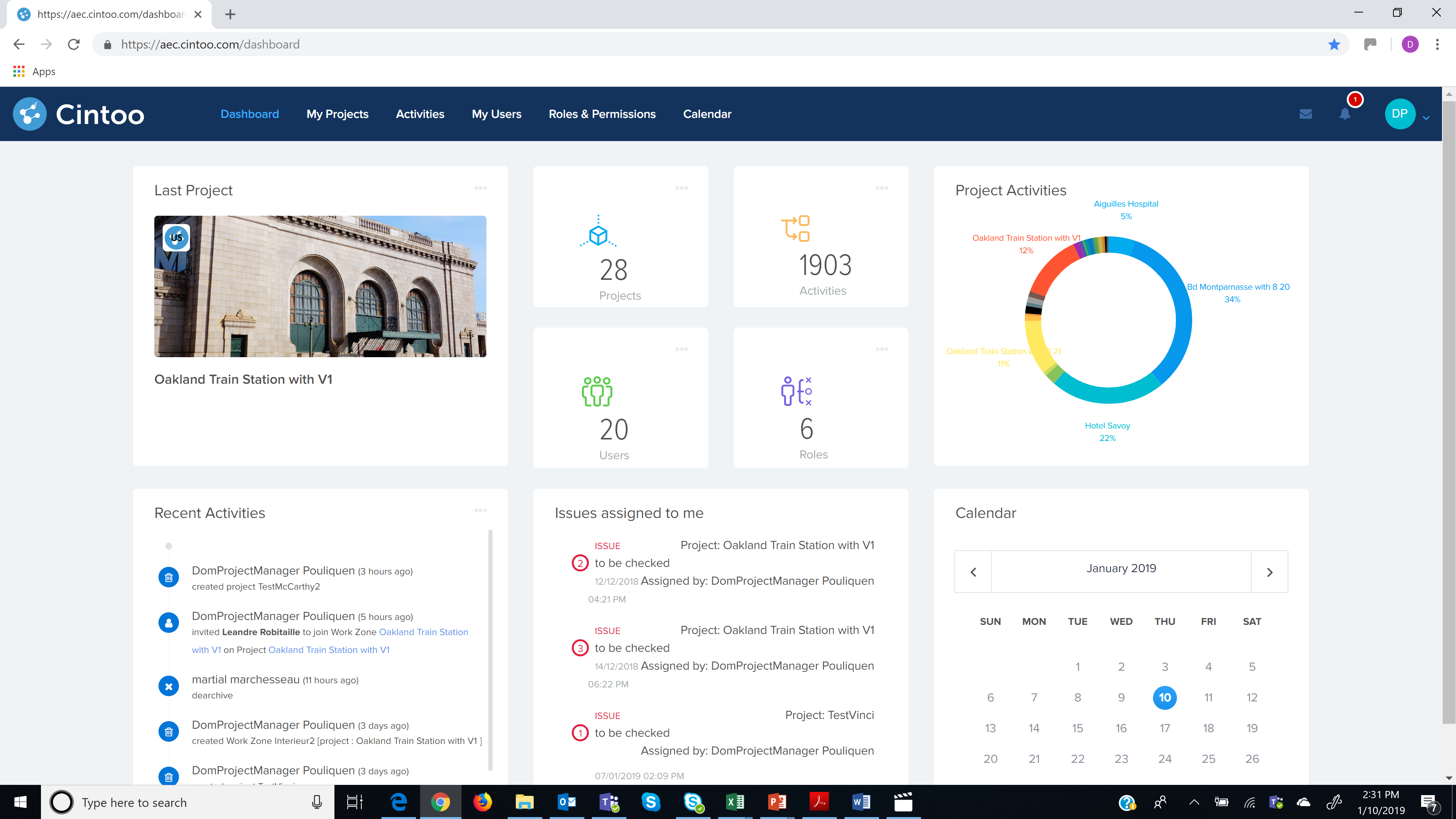
Cintoo Cloud dashboard for BIM/VDC Managers ©apps.autodesk.com