- File size:
- N/A
- Date added:
- Jun 26, 2023 | Last update check: 1 minute ago
- Licence:
- Trial | Buy Now
- Runs on:
- Windows 8.1 64-bit / 10 64-bit / 11 Windows Server 2012 R2 / Server 2016 / Server 2019 / Server 2022
ArcGIS CityEngine (formerly Esri CityEngine) is a conceptual design and procedural modeling software for the creation of 3D cities and buildings based on existing GIS data. It is an essential tool for anyone working with 3D urban environments, both real and imagined. CityEngine is intended for professional users across industries including: architecture, urban planning, entertainment (films, commercials, games), real-world simulation, GIS, and general 3D content production.
CityEngine is based on procedural modeling, which means that 3D geometries and textures are constructed using procedural rules instead of manual modeling. You can generate many 3D models using a single procedural rule. The accuracy of those generated models depends on how many attributes you have.
CityEngine can export 3D GIS data or city models to Unity or other VR/AR solutions. It supports import/export of FBX and KML files. You can export CityEngine web scenes (3WS) to CityEngine Web Viewer on ArcGIS Online and ArcGIS Enterprise, and view it in 3D on browsers that support WebGL. CityEngine does not support LiDAR data.
You can automatically generate LOD1 buildings in CityEngine: use the CityEngine’s “Get map data” functionality to get the building footprints, and a detailed DSM (digital surface model, including buildings) to compute the building height. Get map data imports OSM data and the underlying digital terrain model.
CityEngine is integrated into the ArcGIS 3D platform, the family of applications that includes solutions such as ArcGIS Pro, ArcGIS Desktop (ArcMap and ArcCatalog), ArcGIS Online and ArcGIS Enterprise. CityEngine can be used either in isolation or as part of existing workflows.
With CityEngine you can create 3D cities and buildings based on their existing 2D/3D GIS data. Also it enables you to modify/update 3D city data; do conceptual Geodesign in 3D based on GIS data and (urban planning) procedural rules; save the changes directly to the geodatabase for further analysis; share 3D City and Campus scenes through ArcGIS Online (browser-based).
CityEngine allows you to create 3D content using nothing more than a combination of 2D data, attributes, and procedurally defined rules. This means that any GIS organization will be able to create visually stunning 3D urban environments using the data they already have. CityEngine relies on three key topics: feature geometry, feature attributes, and procedurally defined rules. The more detail provided in each of these elements, the greater the complexity and real-world accuracy that will be included in the generated 3D content.
Another key feature of CityEngine is the ability to design in 3D. Because the 3D city model is rule driven, iterating through a number of design scenarios is as easy as changing rule parameters. While designing, integrated reporting of important building parameters such as Floor Area Ratio (density) lot coverage is available.
The ability to visualize urban planning and zoning rules in 3D is also important in the design process. Zoning regulations are text-based descriptions (per city) of allowed building volumes, usage, and density. They are the main tool defining the image of a city and/or growth/development investment money. In most cases, however, they are hard to understand by the public and other stakeholders. This is where CityEngine comes to the assistance.
CityEngine was initially developed at ETH Zurich by Pascal Mueller, co-founder and CEO of Procedural Inc. In 2008, the first commercial version of CityEngine was released. In 2011, Procedural Inc. was acquired by Esri.
Features:
- 3D modeling tools. Easily create real-world or imaginary environments. Build large urban environments with procedural modeling and scripting.
- Visualize and measure scenarios. Create multiple design alternatives within a single scene and compare them. Display scenarios side-by-side for visual comparison and analysis.
- Maximize integration. Export your CityEngine scenes as industry standard 3D data formats.
- Showcase your designs. Publish your 3D models online and make it easier for others to interact with you.
Typical workflow:
- Choose area. Find your area of interest. Use Get Map Data to import basemap and terrain data.
- Sketch and design. Add or sketch your streets, city blocks, and parcels.
- Add 3D. Move 2D data into 3D models. Add rooftops, furniture, vegetation, and other 3D assets.
- Add details. Texturize your buildings and facades. Add more details to your 3D models.
- Export. Export your finished 3D city to the web, VR experiences, game engines or a geodatabase.
What’s new in version 2023:
- More basemaps and vector tiles in Get Map Data.
- Improved terrain rendering performance through adaptive rendering.
- New Terrain Smooth Brush for terrain editing.
- New dynamic imports feature in CGA.
- Improved ArcGIS Urban integration: import new scenarios from ArcGIS Urban to CityEngine.
- Clipping planes for bookmarks.
- New set of low-poly trees in Esri.lib.
- New and updated tutorials.
About Esri
Esri (Environmental Systems Research Institute) is the global market leader in GIS (geographic information system) technology, location intelligence, mapping software, and spatial analytics. Esri engineers solutions for digital transformation, the Internet of Things (IoT), and advanced analytics. Their core product is ArcGIS, the geospatial cloud platform.
Esri was founded in 1969 and is headquartered in Redlands, California.
Gallery
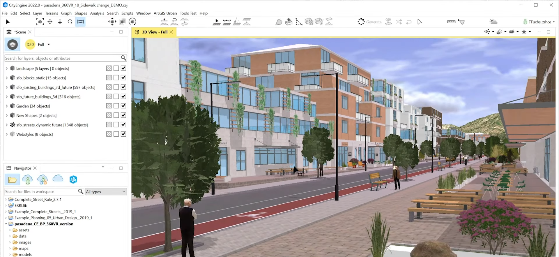
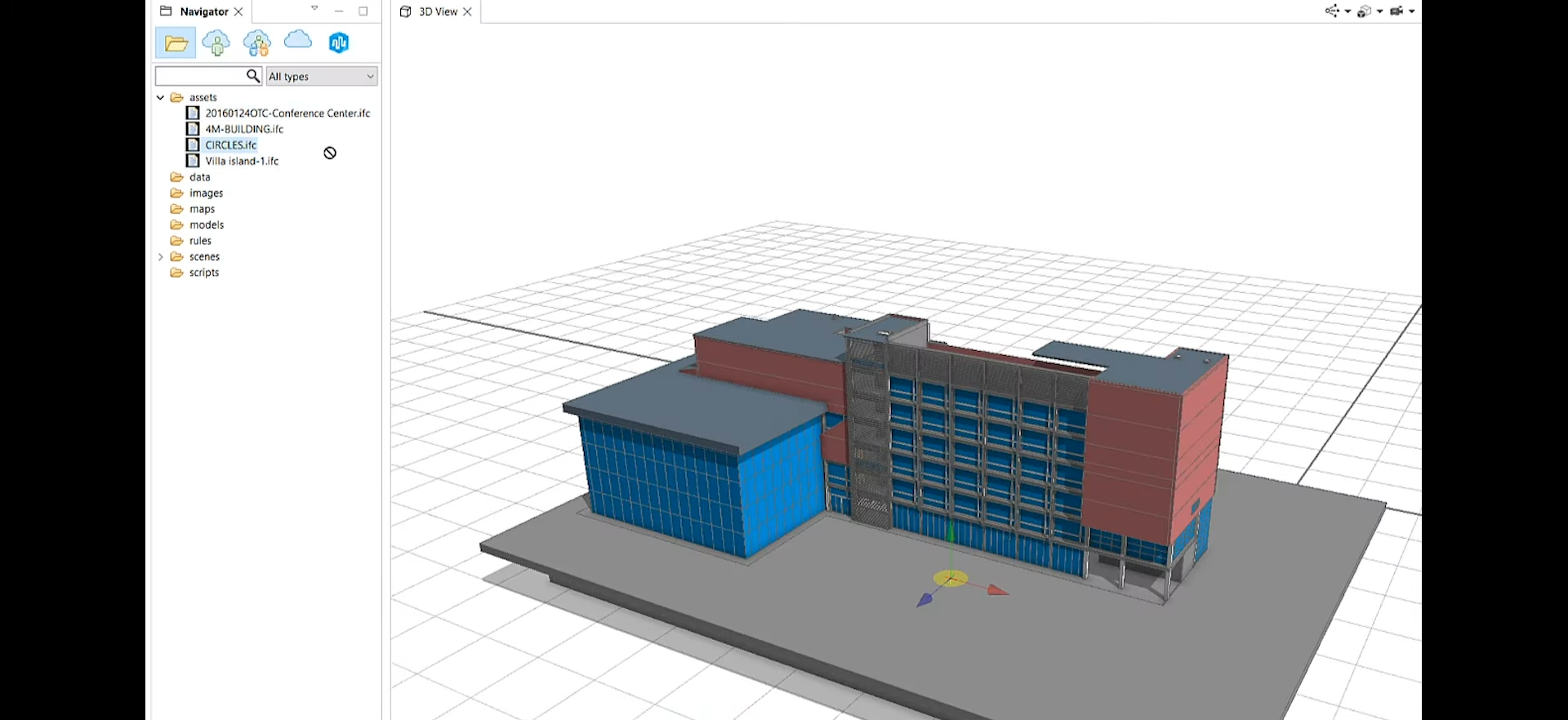
ArcGIS CityEngine 3D view. ©Esri
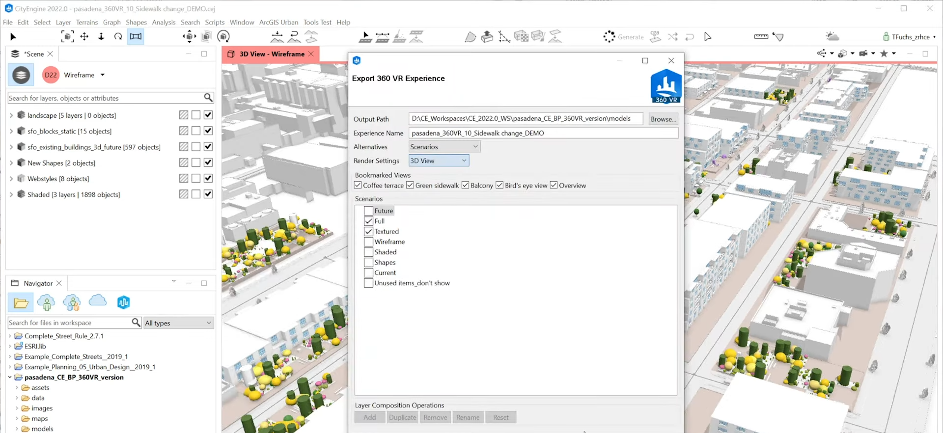
Export to ArcGIS 360 VR. ©Esri
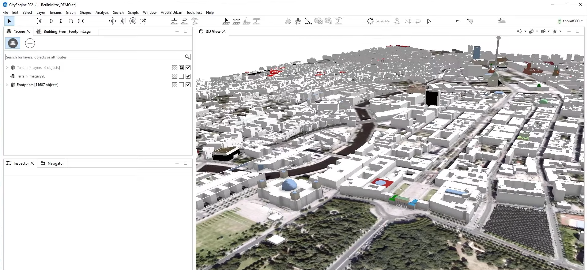
Accurate buildings in Get Map Data. ©Esri
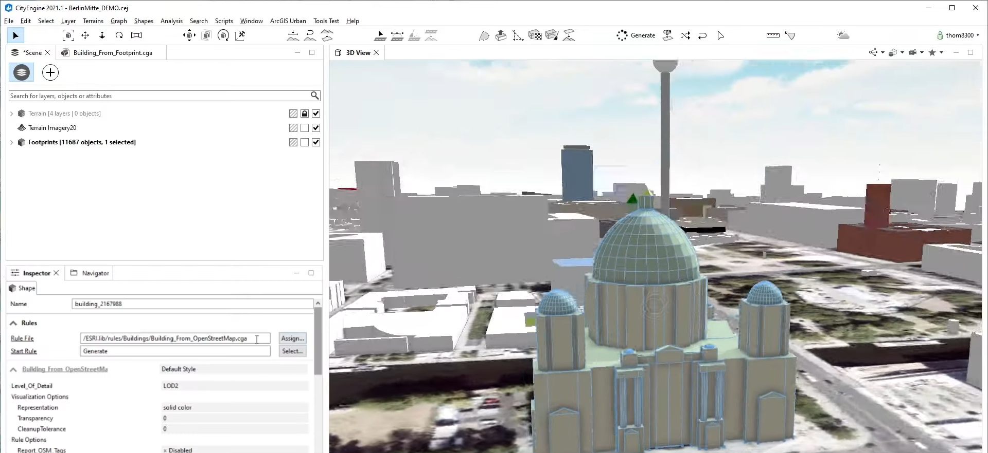
Accurate buildings in Get Map Data. ©Esri
IFC import/export. ©Esri