- File size:
- 1.9 MB
- Date added:
- Jul 08, 2022 | Last update check: 1 minute ago
- Licence:
- Trial
- Runs on:
- Navisworks Manage 2018 / 2019 / 2020 / 2021 / 2022 / 2023 Navisworks Simulate 2018 / 2019 / 2020 / 2021 / 2022 / 2023
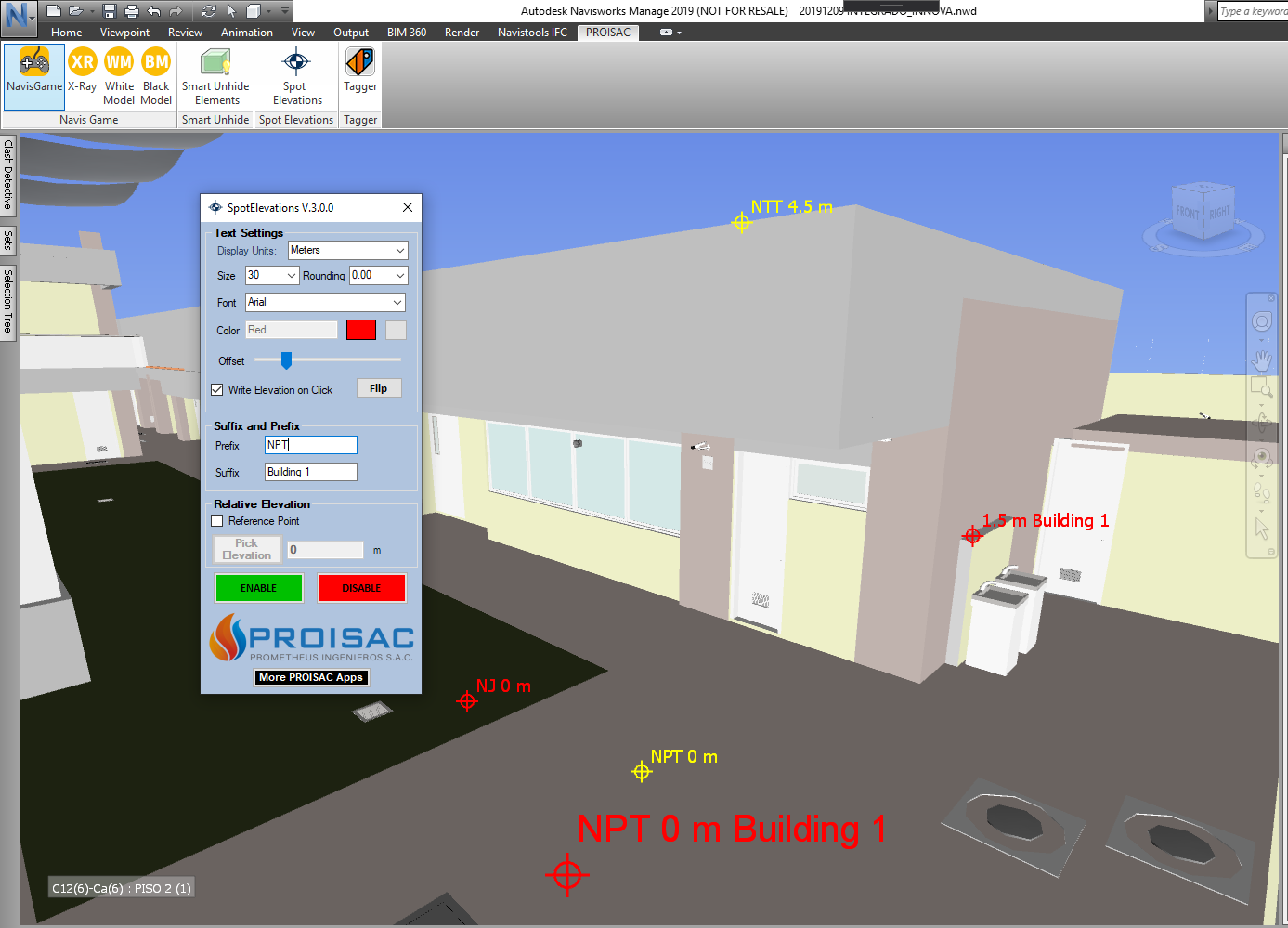
Spot Elevations for Navisworks is an add-in that will spot the elevation of any element in Navisworks model as you move the mouse on the screen. It enables you to visualize the elevation of any element. Just activate Spot Elevations and your mouse pointer will have a dynamic text next to it. This text will show the elevation on the location of the mouse. You can spot the real elevation or a relative elevation to a point. Relative elevation is useful to quickly measure the height of the elements in your project and evaluate if they are accomplishing technical requirements. Easily verify the free clearance of pipes, ducts, cable trays and structural framings. Also you can configure some options inside the floating window. Similar to Revit, you can create elevation marks of any point.
Typical workflow:
- Activate Spot Elevations. Download and install the plugin. In Navisworks, go to the Proisac tab and click the “Spot Elevations” button.
- Set options. A floating form provides you with several options:
- Display Units. Choose display units.
- Rounding. Select Decimal precision.
- Color. Change the color of the elevation text for a better visualization.
- Size. Change the size of the elevation text.
- Font. Choose any of the text fonts installed in your computer.
- Offset. Change the offset of the elevation text to the cursor pointer, by moving the slider.
- Write Elevation on Click. Write the elevation on a SavedViewPoint when clicking a point.
- Prefix and Suffix. Add a prefix or suffix to the spot elevation text.
- Reference Point. Spot an elevation relative to an element or elevation. Check the relative elevation option (“Reference Point” checkbox), and pick a point to get the elevation as reference or set an elevation of reference. The text will show the elevation relative to the reference. To disable the reference point option just uncheck the “Reference Point” box and the text will show you the absolute elevation again.
- Enable/disable spot elevations. Use the “Enable” and “Disable” buttons to activate or deactivate the plugin.
What’s new in version 5.0.0:
- Support for Navisworks 2023.
About Proisac
Proisac provides services in engineering and architecture, oriented to the use of BIM technology and VDC work methodology, through the Autodesk Revit and Autodesk Naviswork software. Proisac was founded in 2014 and is headquartered in Lima, Peru.
Gallery
Create spot elevations in Navisworks. Use any inserted BIM model. ©Autodesk